
Open-File Report 2007-1191
![]() Title |
Introduction |
Setting |
Methods |
Results |
Discussion |
Data Catalog |
Acknowledgments |
References |
Figures |
Contacts
Title |
Introduction |
Setting |
Methods |
Results |
Discussion |
Data Catalog |
Acknowledgments |
References |
Figures |
Contacts
 |
||
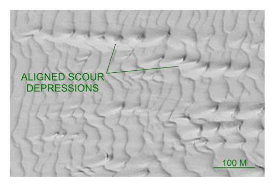
Figure 34. Detailed planar view of multibeam bathymetry from survey H11252 showing the aligned isolated depressions that form in troughs of adjacent sand waves. Locations of detailed view is shown in figure 16. | ||

![]() U.S. Department of the Interior |
U.S. Geological Survey
U.S. Department of the Interior |
U.S. Geological Survey
URL: http://pubsdata.usgs.gov/pubs/of/2007/1191/html/fig34.html
Page Contact Information: GS Pubs Web Contact
Page Last Modified: Thursday, 05-Dec-2024 08:47:28 EST


