Open-File Report 2007–1255
U.S. GEOLOGICAL SURVEY
Open-File Report 2007–1255
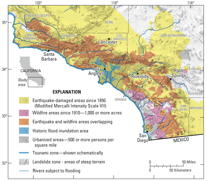
Figure 1. Shaded relief map of southern California showing geographical extent and overlap of different hazards. The region of study will span the urban areas of southern California, including the Los Angeles and San Diego metropolitan areas, and extending north to Santa Barbara and Lancaster, south to the Mexico border, and east to Palm Springs.

![]() U.S. Department of the Interior | U.S. Geological Survey
U.S. Department of the Interior | U.S. Geological Survey
URL: https://pubs.usgs.gov/ofr/2007/1255
Page Contact Information: Publications Team
Page Last Modified: Wednesday, 07-Dec-2016 20:22:45 EST
