Open-File Report 2007-1278
 |
||
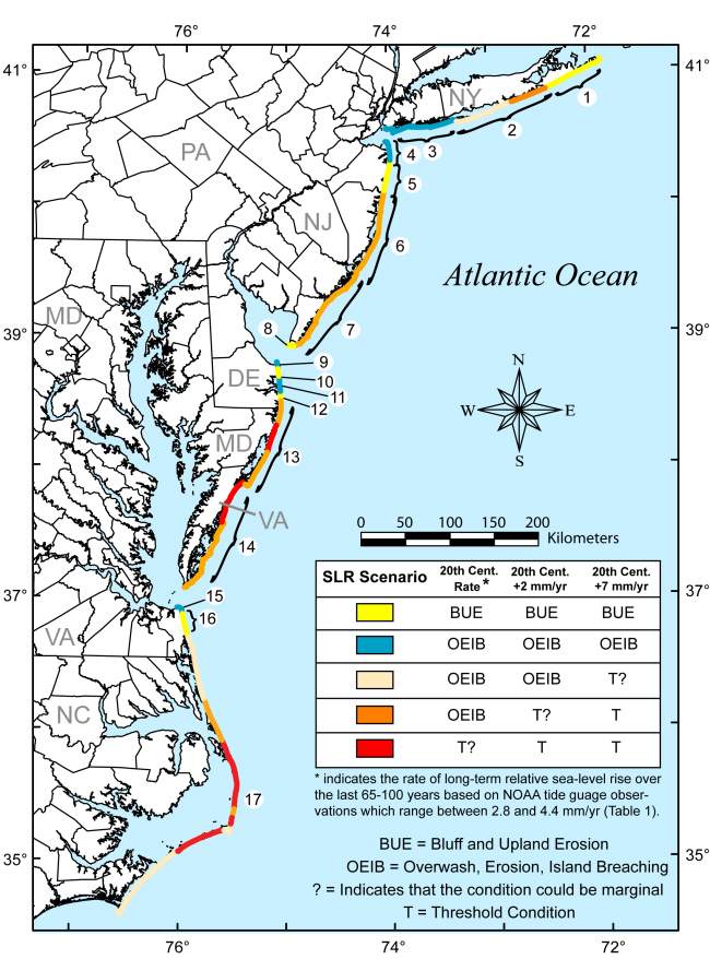
Figure 3. Map showing the potential sea-level rise responses for each coastal compartment. Colored portions of the coastline indicates the potential response for a given sea-level rise scenario according to the inset table. Numbers indicate the coastal compartments shown in Figure 1. | ||

![]() U.S. Department of the Interior |
U.S. Geological Survey
U.S. Department of the Interior |
U.S. Geological Survey
URL: http://pubsdata.usgs.gov/pubs/of/2007/1278/html/fig3.html
Page Contact Information: GS Pubs Web Contact
Page Last Modified: Thursday, 05-Dec-2024 10:57:52 EST
