Open-File Report 2007–1357
  Executive Summary
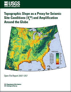
It is well-known that large global earthquakes can have a dramatic effect on local communities and the built environment. Moreover, ground motions amplified by surficial materials can exacerbate the situation, often making the difference between minor and major damage. For a real-time earthquake impact alert system, such as Prompt Assessment of Global Earthquakes for Response (PAGER) (Wald and others, 2006), we seek to rapidly evaluate potential ground shaking in the source region and subsequently provide an estimate of the population exposure to potentially fatal levels of ground shaking in any region of the world. The contribution of surficial geology (particularly soft sediments) to the amplification of ground shaking is an important component in predicting the levels of ground motion observed at any site. Unfortunately, the availability of information regarding seismic siteconditions is only available at a few sites around the globe. Herein, we describe a methodology for deriving maps of seismic site-conditions anywhere in the world using topographic slope as a proxy. Average shear-velocity down to 30 m (or VS30) measurements are correlated against topographic slope to develop two sets of coefficients for predicting VS30: one for active tectonic regions that possess dynamic topographic relief, and one for stable continental regions where changes in topography are more subdued. These coefficients have been applied to the continental United States, in addition to other regions around the world. They are subsequently compared to existing site-condition maps based on geology and observed VS30 measurements, where available. The application of the topographic slope method in regions with abundant VS30 measurements (for example California, Memphis, and Taiwan) indicates that this method provides site condition-maps of similar quality, or in some cases, maps superior to those developed from more traditional techniques. Having a first-order assessment of seismic site-conditions anywhere in the world provides a valuable tool to rapidly estimate ground motions following any global earthquake, the primary motivation for this research. These VS30 maps will enable us to better quantify possible ground shaking and rapidly deliver these predictions to emergency managers and responders. In addition, the VS30 maps for the globe will also have practical applications for numerous related probabilistic- and scenario-based studies. To date, several researchers have requested maps or have used the approach outlined herein for their own applications (for example Cagnan and Kariptas, written commun., 2007; Harmandar and others, 2007). Given that we anticipate a significant demand for these products, we have developed an internet delivery service so that users can download maps and grids of seismic site-conditions for specified regions. To some extent, these grids can also be customized by the user if they disagree with the predefined correlations derived using the methodologies described within this report. Finally, this report represents a more comprehensive account of this technique and provides a more fully illustrated global description of results than that given in Wald and Allen (2007), which has been accepted for publication in the Bulletin of the Seismological Society of America. |
Version 1.0 Posted November 2007 |
Allen, T.I., and Wald, D.J., 2007, Topographic slope as a proxy for global seismic site conditions (VS30) and amplification around the globe: U.S. Geological Survey Open-File Report 2007-1357, 69 p.

![]() U.S. Department of the Interior | U.S. Geological Survey
U.S. Department of the Interior | U.S. Geological Survey
URL: http://pubsdata.usgs.gov/pubs/of/2007/1357/index.html
Questions or Assistance: Contact USGS
Last modified: Wednesday, 07-Dec-2016 20:25:49 EST
