USGS-NPS-NASA EAARL Topography
|
|
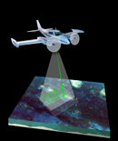
Located on this CD is a folder named Lidar. Each subfolder within the Lidar folder contains an edited Lidar DEM GeoTIFF, hillshade grid, and contour shapefile, for the specific map tile. The sub-folders are named according to the UTM coordinates of their upper-left corner (in thousands). Each GIS layer has an accompanying XML file that holds the metadata. There is also a folder named Shapefiles which contains the vector data that was used while creating the PDF maps. These layers include the coastline of New York, the boundary of Long Island, the boundary of Sagamore Hill National Historic Site, and the Lidar tile centroids. All files are consistent with the UTM Zone 19 N Coordinate System, NAD83 Datum, and GRS80 Spheroid. From the list below, select a tile to see a folder of associated GIS layers for that region.
|

![]() U.S.
Department of the Interior | U.S.
Geological Survey
U.S.
Department of the Interior | U.S.
Geological Survey
URL: http://pubsdata.usgs.gov/pubs/of/2007/1394/HTML/raw_data.html
For more information, contact: Feedback
Maintained by Publishing Service Center
Page Last Modified: Wednesday, 07-Dec-2016 20:37:39 EST