Open-File Report 2008–1024
Executive Summary
The U.S. Bureau of Land Management (BLM) is currently developing a National Monitoring Strategy that will guide efforts to create an efficient and effective process for monitoring land health by BLM. To inform the ongoing development of the national strategy, BLM selected two States (Colorado, Alaska) to serve as focal areas on which to base a flexible framework for developing monitoring programs that evaluate wildlife responses to energy development.
We developed a three-phase monitoring plan to serve as a template and applied it to the design of a monitoring program for the Colorado focal area (White River and Glenwood Springs Field Offices of the BLM). Phase I is a synthesis and assessment of current conditions that capitalizes on existing but under used data sources. A key component is the use of existing habitat and landscape models to evaluate the cumulative effects of surface disturbance. Phase II is the data collection process that uses information provided in Phase I to refine management objectives and provide a linkage to management decisions. The linkage is established through targeted monitoring, adaptive management, and research. Phase III establishes priorities and strategies for regional and national monitoring, and facilitates coordination among other land management agencies and organizations. The three phases are designed to be flexible and complementary.
The monitoring plan guides an iterative process that is performed incrementally, beginning with the highest-priority species and management issues, while building on lessons learned and coordination among administrative levels. The activities associated with each phase can be repeated or updated as new information, data, or tools become available. This allows the development of a monitoring program that expands gradually and allows for rapid implementation.
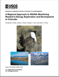
A demonstration application of the three-phase monitoring plan was conducted for a study area encompassing five BLM field offices in Colorado: White River, Glenwood Springs, Kremmling, Grand Junction, and Little Snake. The overall study area was selected to encompass the primary distribution of sagebrush and greater sage-grouse (Centrocercus urophasianus) in Colorado and to provide a larger context for evaluating priority management issues of the White River and Glenwood Springs Field Offices. Within the study area, we selected an additional scale of analysis: the Roan Plateau, an area of increased energy development. We focused our demonstration project on the primary objectives identified by the BLM and other stakeholders: (1) How do we evaluate the cumulative effects of energy development and mitigation activities on species of management interest or concern? (2) How can cumulative effects, including direct and indirect effects, be quantified relative to natural variation?
(3) How can we implement compliance and effectiveness monitoring to determine whether lease stipulations are met and restoration/mitigation goals are achieved?
We targeted greater sage-grouse because this species was identified as a monitoring priority for the White River Field Office. We also evaluated landscape-level indices to address fragmentation resulting from surface disturbance. The primary purpose of this exercise was to highlight the types of analyses and approaches that could be used to evaluate energy development in an application of the three-phase framework. We provide examples of Phase I products that can be used to guide the refinement of management objectives, development of adaptive management and research frameworks, and planning activities in Phase II. Finally, we report on the BLM’s National Sage-Grouse Habitat Conservation Strategy as an example of Phase III activities.
The development of an effective monitoring program is a daunting task, and will be difficult to implement by the BLM independently due to the current work load of staff. However, the scientific expertise and experience for developing credible and scientifically sound monitoring programs is available through partners currently involved in assisting other agencies with their monitoring programs [for example, U.S. Geological Survey (USGS), academic institutions, and The Nature Conservancy]. BLM can capitalize on available expertise by partnering with other agencies, which also will help to coordinate activities in Phase III of the monitoring plan. |
Version 1.0 Posted August 2008 Part or all of this report is presented in Portable Document Format (PDF); the latest version of Adobe Reader or similar software is required to view it. Download the latest version of Adobe Reader, free of charge. |
Kotliar, N.B., Bowen, Z.H., Ouren, D.S., and Farmer, A.H., 2008, A regional approach to wildlife monitoring related to energy exploration and development in Colorado: U.S. Geological Survey Open-File Report 2008–1024, 66 p.
Executive Summary
Background and Objectives
Monitoring Plan Overview
Guidelines for Implementation
Three-Phase Monitoring Plan
Phase I: Synthesize and Integrate Existing Data and Models to Conduct Status Assessments
Phase I Demonstration
Phase II: Collect Data to Address Priority Management Objectives Through Targeted Monitoring, Adaptive Management, and Research
Phase II Demonstration
Phase III: Coordination and Integration of Regional, National, and Interagency Monitoring Strategies
Phase III Demonstration
Summary
Acknowledgments
References Cited
Glossary
Appendix A. Existing Monitoring Frameworks and Assessments
Appendix B. Habitat and Disturbance Modeling for Greater Sage-Grouse
Appendix C. Landscape Analysis
Appendix D. State and Transition Model for Greater Sage-Grouse
Appendix E. Road Analysis for the Roan Plateau

![]() U.S. Department of the Interior | U.S. Geological Survey
U.S. Department of the Interior | U.S. Geological Survey
URL: http://pubsdata.usgs.gov/pubs/of/2008/1024/index.html
Questions or Assistance: Contact USGS
Last modified: Wednesday, 07-Dec-2016 21:24:06 EST