Arizona Water Science Center
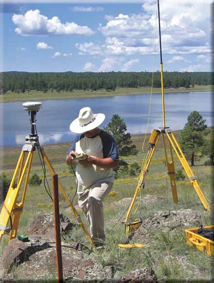
U.S. Geological Survey personnel setting up surveying equipment by Upper Lake Mary, Arizona.
Upper Lake Mary is a preferred drinking-water source for the City of Flagstaff, Arizona. Therefore, storage capacity and sedimentation issues in Upper Lake Mary are of interest to the City. The U.S. Geological Survey, in cooperation with the City of Flagstaff, collected bathymetric and land-survey data in Upper Lake Mary during late August through October 2006. Water-depth data were collected using a single-beam, high-definition fathometer. Position data were collected using real-time differential global position system receivers. Data were processed using commercial software and imported into geographic information system software to produce contour maps of lakebed elevations and for the computation of area and storage-capacity information.
At full pool (spillway elevation of 6,828.5 feet above mean sea level), Upper Lake Mary has a storage capacity of 16,300 acre-feet, a surface area of 939 acres, a mean depth of 17.4 feet, and a depth near the dam of 39 feet. It is 5.6 miles long and varies in width from 308 feet near the central, narrow portion of the lake to 2,630 feet in the upper portion. Comparisons between this survey and a previous survey conducted in the 1950s indicate no apparent decrease in reservoir area or storage capacity between the two surveys.
Download the text for this report as a 26-page PDF file (of2008-1098.pdf; 4.6 MB)
For questions about the content of this report, contact Nancy Hornewer
Download the Suggested citation and version history
Download a free copy of the current version of Adobe Reader.
| Help
| PDF help
| Publications main page | Western Open-File Reports for 2008 |
| Water Resources | Arizona Water Science Center
|
This report is available only on the Web

![]() U.S. Department of the Interior | U.S. Geological Survey
U.S. Department of the Interior | U.S. Geological Survey
URL: https://pubs.usgs.gov/of/2008/1098/
Page Contact Information: Michael Diggles
Page Last Modified: June 5, 2008