Open-File Report 2008–1125
Derivation of Ground Surface and Vegetation in a Coastal Florida Wetland with Airborne Laser Technology
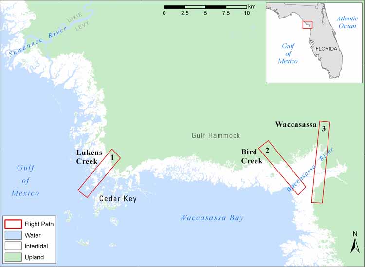
This directory contains raster (GeoTIFF) files and shoreline vector (shape) files for Lukens Creek and Waccasassa/Bird Creek study areas at 2-m resolution. Bare-earth DSM and canopy-height DSM values represent 10x actual value to facilitate application in 8-bit raster format. Each raster file is accompanied by an ESRI layer file to mimic illustrations in the Open-File Report. To access the data from this DVD, download the files to your computer.
Data Files: |
 |
||

![]() U.S. Department of the Interior |
U.S. Geological Survey
U.S. Department of the Interior |
U.S. Geological Survey
URL: https://pubsdata.usgs.gov/pubs/of/2008/1125/html/Data.html
Page Contact Information: Web team
Page Last Modified: Wednesday, 07-Dec-2016 21:21:35 EST
