Open-File Report 2008-1195
Geophysical Data from Offshore of the Chandeleur Islands, Eastern Mississippi Delta
![]() Title Page /
Contents /
Introduction /
Data Acquisition and Processing Overview /
Geographic Information System Data Catalog /
Acknowledgments /
References Cited
Title Page /
Contents /
Introduction /
Data Acquisition and Processing Overview /
Geographic Information System Data Catalog /
Acknowledgments /
References Cited
 |
||
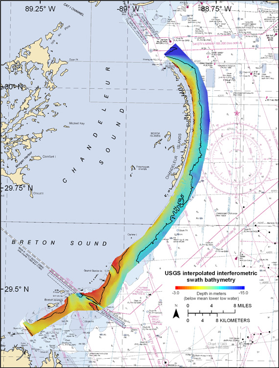
| Figure 3. Map showing the interpolated interferometric swath bathymetric data collected offshore of the Chandeleur Islands in eastern Louisiana in 2006 and 2007. | ||

![]() U.S. Department of the Interior |
U.S. Geological Survey
U.S. Department of the Interior |
U.S. Geological Survey
URL: http://pubsdata.usgs.gov/pubs/of/2008/1195/html/imagepages/fig3.html
Page Contact Information: GS Pubs Web Contact
Page Last Modified: Friday, 08-Aug-2025 12:47:01 EDT
