Abstract
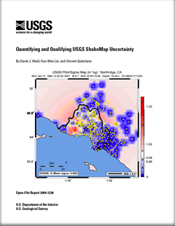 We describe algorithms for quantifying and qualifying uncertainties associated with USGS ShakeMap ground motions. The uncertainty values computed consist of latitude/longitude grid-based multiplicative factors that scale the standard deviation associated with the ground motion prediction equation (GMPE) used within the ShakeMap algorithm for estimating ground motions. The resulting grid-based "uncertainty map" is essential for evaluation of losses derived using ShakeMaps as the hazard input. For ShakeMap, ground motion uncertainty at any point is dominated by two main factors: (i) the influence of any proximal ground motion observations, and (ii) the uncertainty of estimating ground motions from the GMPE, most notably, elevated uncertainty due to initial, unconstrained source rupture geometry. The uncertainty is highest for larger magnitude earthquakes when source finiteness is not yet constrained and, hence, the distance to rupture is also uncertain. In addition to a spatially-dependant, quantitative assessment, many users may prefer a simple, qualitative grading for the entire ShakeMap. We developed a grading scale that allows one to quickly gauge the appropriate level of confidence when using rapidly produced ShakeMaps as part of the post-earthquake decision-making process or for qualitative assessments of archived or historical earthquake ShakeMaps. We describe an uncertainty letter grading ("A" through "F", for high to poor quality, respectively) based on the uncertainty map. A middle-range ("C") grade corresponds to a ShakeMap for a moderate-magnitude earthquake suitably represented with a point-source location. Lower grades “D” and “F” are assigned for larger events (M>6) where finite-source dimensions are not yet constrained. The addition of ground motion observations (or observed macroseismic intensities) reduces uncertainties over data-constrained portions of the map. Higher grades ("A" and "B") correspond to ShakeMaps with constrained fault dimensions and numerous stations, depending on the density of station/data coverage. Due to these dependencies, the letter grade can change with subsequent ShakeMap revisions if more data are added or when finite-faulting dimensions are added. We emphasize that the greatest uncertainties are associated with unconstrained source dimensions for large earthquakes where the distance term in the GMPE is most uncertain; this uncertainty thus scales with magnitude (and consequently rupture dimension). Since this distance uncertainty produces potentially large uncertainties in ShakeMap ground-motion estimates, this factor dominates over compensating constraints for all but the most dense station distributions. We describe algorithms for quantifying and qualifying uncertainties associated with USGS ShakeMap ground motions. The uncertainty values computed consist of latitude/longitude grid-based multiplicative factors that scale the standard deviation associated with the ground motion prediction equation (GMPE) used within the ShakeMap algorithm for estimating ground motions. The resulting grid-based "uncertainty map" is essential for evaluation of losses derived using ShakeMaps as the hazard input. For ShakeMap, ground motion uncertainty at any point is dominated by two main factors: (i) the influence of any proximal ground motion observations, and (ii) the uncertainty of estimating ground motions from the GMPE, most notably, elevated uncertainty due to initial, unconstrained source rupture geometry. The uncertainty is highest for larger magnitude earthquakes when source finiteness is not yet constrained and, hence, the distance to rupture is also uncertain. In addition to a spatially-dependant, quantitative assessment, many users may prefer a simple, qualitative grading for the entire ShakeMap. We developed a grading scale that allows one to quickly gauge the appropriate level of confidence when using rapidly produced ShakeMaps as part of the post-earthquake decision-making process or for qualitative assessments of archived or historical earthquake ShakeMaps. We describe an uncertainty letter grading ("A" through "F", for high to poor quality, respectively) based on the uncertainty map. A middle-range ("C") grade corresponds to a ShakeMap for a moderate-magnitude earthquake suitably represented with a point-source location. Lower grades “D” and “F” are assigned for larger events (M>6) where finite-source dimensions are not yet constrained. The addition of ground motion observations (or observed macroseismic intensities) reduces uncertainties over data-constrained portions of the map. Higher grades ("A" and "B") correspond to ShakeMaps with constrained fault dimensions and numerous stations, depending on the density of station/data coverage. Due to these dependencies, the letter grade can change with subsequent ShakeMap revisions if more data are added or when finite-faulting dimensions are added. We emphasize that the greatest uncertainties are associated with unconstrained source dimensions for large earthquakes where the distance term in the GMPE is most uncertain; this uncertainty thus scales with magnitude (and consequently rupture dimension). Since this distance uncertainty produces potentially large uncertainties in ShakeMap ground-motion estimates, this factor dominates over compensating constraints for all but the most dense station distributions.
|

