Geographic Analysis and Monitoring Program
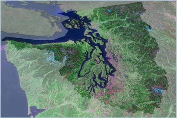
1990 Landsat Mosaic of the Puget Sound Integrated Landscape Monitoring Study Area
This report summarizes existing geospatial data and monitoring programs for the Puget Sound Basin in northwestern Washington. This information was assembled as a preliminary data-development task for the U.S. Geological Survey (USGS) Puget Sound Integrated Landscape Monitoring (PSILM) pilot project. The PSILM project seeks to support natural resource decision-making by developing a “whole system” approach that links ecological processes at the landscape level to the local level (Benjamin and others, 2008). Part of this effort will include building the capacity to provide cumulative information about impacts that cross jurisdictional and regulatory boundaries, such as cumulative effects of land-cover change and shoreline modification, or region-wide responses to climate change.
The PSILM project study area is defined as the 23 HUC-8 (hydrologic unit code) catchments that comprise the watersheds that drain into Puget Sound and their near-shore environments. The study area includes 13 counties and more than four million people. One goal of the PSILM geospatial database is to integrate spatial data collected at multiple scales across the Puget Sound Basin marine and terrestrial landscape.
The PSILM work plan specifies an iterative process that alternates between tasks associated with data development and tasks associated with research or strategy development. For example, an initial work-plan goal was to delineate the study area boundary. Geospatial data required to address this task included data from ecological regions, watersheds, jurisdictions, and other boundaries. This assemblage of data provided the basis for identifying larger research issues and delineating the study-area boundary based on these research needs. Once the study-area boundary was agreed upon, the next iteration between data development and research activities was guided by questions about data availability, data extent, data abundance, and data types.
This report is not intended as an exhaustive compilation of all available geospatial data, rather, it is a collection of information about geospatial data that can be used to help answer the suite of questions posed after the study-area boundary was defined. This information will also be useful to the PSILM team for future project tasks, such as assessing monitoring gaps, exploring monitoring-design strategies, identifying and deriving landscape indicators and metrics, and visual geographic communication.
The two main geospatial data types referenced in this report—base-reference layers and monitoring data—originated from numerous and varied sources. In addition to collecting information and metadata about the base-reference layers, the data also were collected for project needs, such as developing maps for visual communication among team members and with outside groups. In contrast, only information about the data was typically required for the monitoring data. The information on base-reference layers and monitoring data included in this report is only as detailed as what was readily available from the sources themselves. Although this report may appear to lack consistency between data records, the varying degree of details contained in this report are merely a reflection of varying source detail.
This compilation is just a beginning. All data listed also are being catalogued in spreadsheets and knowledge-management systems. Our efforts are continual as we develop a geospatial catalog for the PSILM pilot project.
Download text of this report as a 114-page PDF file (of2008-1308.pdf; 43.5 MB)
For questions about the content of this report, contact Danielle Aiello.
Suggested citation and version history
Download a free copy of the latest version of Adobe Reader.
|
Help |
PDF help |
Publications main page |
| Western Open-File Reports for 2008 |
| Geography | Geographic Analysis and Monitoring Program
|

![]() U.S. Department of the Interior | U.S. Geological Survey
U.S. Department of the Interior | U.S. Geological Survey
URL: https://pubs.usgs.gov/of/2008/1308/
Page Contact Information: Michael Diggles
Page Created: September 30, 2008
Page Last Modified: October 1, 2008