U.S. Geological Survey Open-File Report 2009-1072
Geophysical and Sampling Data from the Inner Continental Shelf: Duxbury to Hull, Massachusetts
Click on an image below for a higher resolution image.
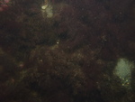
 dl2_PICT0216.JPG Station # 081 Lat 42.11896 Long -70.660695 Time(UTC) 19:49:07 |
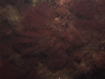
 dl2_PICT0217.JPG Station # 081 Lat 42.119094 Long -70.660606 Time(UTC) 19:49:33 |
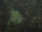
 dl2_PICT0218.JPG Station # 081 Lat 42.119199 Long -70.660474 Time(UTC) 19:50:05 |
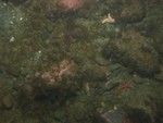
 dl2_PICT0219.JPG Station # 081 Lat 42.119295 Long -70.660408 Time(UTC) 19:50:28 |
 dl2_PICT0220.JPG Station # 081 Lat 42.119458 Long -70.660326 Time(UTC) 19:51:05 |
|||
 dl2_PICT0221.JPG Station # 081 Lat 42.11975 Long -70.660366 Time(UTC) 19:52:14 |
 dl2_PICT0222.JPG Station # 081 Lat 42.120117 Long -70.660408 Time(UTC) 19:53:38 |
 dl2_PICT0223.JPG Station # 081 Lat 42.120181 Long -70.660397 Time(UTC) 19:53:52 |
 dl2_PICT0224.JPG Station # 082 Lat 42.13085 Long -70.673225 Time(UTC) 20:07:07 |
 dl2_PICT0225.JPG Station # 082 Lat 42.130974 Long -70.673175 Time(UTC) 20:07:33 |
|||
 dl2_PICT0226.JPG Station # 082 Lat 42.131089 Long -70.673137 Time(UTC) 20:07:58 |
 dl2_PICT0227.JPG Station # 082 Lat 42.131235 Long -70.673088 Time(UTC) 20:08:32 |
 dl2_PICT0228.JPG Station # 082 Lat 42.131661 Long -70.673005 Time(UTC) 20:09:59 |
 dl2_PICT0229.JPG Station # 082 Lat 42.131882 Long -70.672966 Time(UTC) 20:10:44 |
 dl2_PICT0230.JPG Station # 082 Lat 42.132002 Long -70.672945 Time(UTC) 20:11:09 |
|||
 dl2_PICT0231.JPG Station # 082 Lat 42.132062 Long -70.672931 Time(UTC) 20:11:23 |
 dl2_PICT0232.JPG Station # 083 Lat 42.13642 Long -70.658462 Time(UTC) 20:25:29 |
 dl2_PICT0233.JPG Station # 083 Lat 42.136614 Long -70.658176 Time(UTC) 20:26:40 |
 dl2_PICT0234.JPG Station # 083 Lat 42.136874 Long -70.658002 Time(UTC) 20:27:38 |
 dl2_PICT0235.JPG Station # 083 Lat 42.137175 Long -70.657811 Time(UTC) 20:28:48 |
|||
 dl2_PICT0236.JPG Station # 083 Lat 42.137482 Long -70.65767 Time(UTC) 20:29:49 |
 dl2_PICT0237.JPG Station # 083 Lat 42.137835 Long -70.657514 Time(UTC) 20:30:57 |
 dl2_PICT0238.JPG Station # 083 Lat 42.138011 Long -70.657427 Time(UTC) 20:31:30 |
 dl2_PICT0239.JPG Station # 084 Lat 42.128468 Long -70.644661 Time(UTC) 20:44:31 |
 dl2_PICT0240.JPG Station # 084 Lat 42.128572 Long -70.644817 Time(UTC) 20:45:24 |
|||
 dl2_PICT0241.JPG Station # 084 Lat 42.128684 Long -70.645031 Time(UTC) 20:46:32 |
 dl2_PICT0242.JPG Station # 084 Lat 42.1288 Long -70.645215 Time(UTC) 20:47:34 |
 dl2_PICT0243.JPG Station # 084 Lat 42.128941 Long -70.645409 Time(UTC) 20:48:25 |
 dl2_PICT0244.JPG Station # 084 Lat 42.129059 Long -70.645539 Time(UTC) 20:49:05 |
 dl2_PICT0245.JPG Station # 084 Lat 42.129136 Long -70.645619 Time(UTC) 20:49:30 |
|||
 dl2_PICT0246.JPG Station # 084 Lat 42.129189 Long -70.645671 Time(UTC) 20:49:46 |
|||||||


