
Aeromagnetic Survey of Howard Pass Quadrangle and the East Half of Misheguk Mountain Quadrangle, Alaska—A Web Site for the Distribution of Data
Any use of trade, product, or firm names is for descriptive purposes only and does not imply endorsement by the U.S. Government.
- Open-File Report 2009-1256
- U.S. Department of the Interior
- U.S. Geological Survey
![]()
Abstract
U.S. Geological Survey Open-File Report 2009-1256 is for the preliminary release of magnetic data (and associated contractor reports) for an airborne survey in the Brooks Range, northwest of Bettles, Alaska.
| top |
Introduction
An airborne magnetic survey was completed over an area located northwest of Bettles, Alaska in the Brooks Range. The survey was done by Excel Geophysics, Inc. on behalf of the U.S. Geological Survey (USGS). The project area covered the Howard Pass 1:250,000 scale quadrangle and the East half of the Misheguk Mountain 1:250,000 scale quadrangle. Data acquisition was conducted from June 10, 2008, to August 29, 2008, with a total of 15,548.4 km (9,661.3 mi) flown during the survey. Survey parameters include a flight-line spacing of 1,600 m (1 mi) north-south, tie-line spacing of 8 km (5 mi) east-west and a flying height of 304 m (1,000 ft) drape above ground.
| top |
![]()
Merged Aeromagnetic Anomaly Image of Alaska
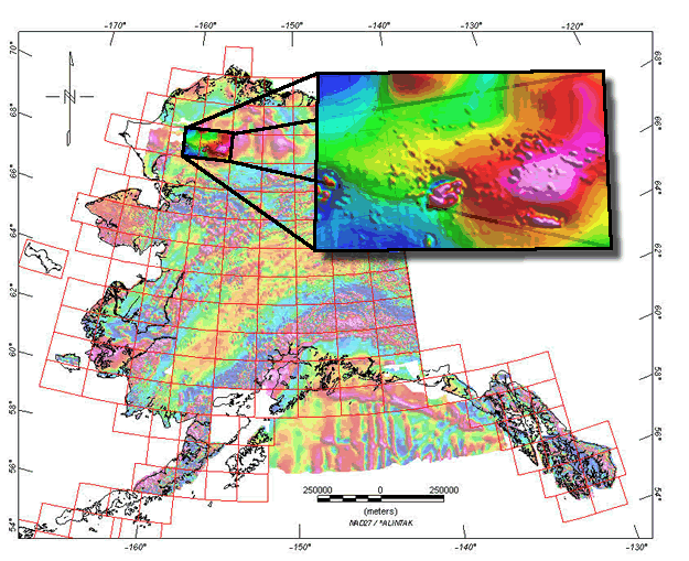
Click here or on image above to enlarge location image and download reports, data, and map images.
| top |
![]()
Some documents on this Web Site are PDF files. Adobe Acrobat Reader is required to view them. Download free Adobe Acrobat Reader to view PDF files at the Adobe Web Site.
![]()

![]() U.S. Department of the Interior |
U.S. Geological Survey
U.S. Department of the Interior |
U.S. Geological Survey
URL: http://pubsdata.usgs.gov/pubs/of/2009/1256/HowardPassAndMishegukMtnMag/main.htm
Page Contact Information: GS Pubs Web Contact
Page Last Modified: Saturday, 12-Jan-2013 19:22:51 EST