U.S. Geological Survey Open-File Report 2010-1251
Moderate-Resolution Sea Surface Temperature Data for the Nearshore North Pacific
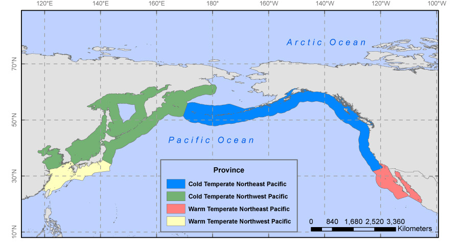 |
Figure 3. Map of the four Marine Ecosystem of the World (MEOW) Provinces that comprise the Temperate Northern Pacific and Arctic Realms (Spalding and others, 2007). The Cold Temperate Northeast Pacific includes the Aleutian Islands and the Pacific coast of North America, from Alaska to Southern California. The Warm Temperate Northeast Pacific contains the Baja Region. The Cold Temperate Northwest Pacific includes the Kamchatka coast of the Bering Sea and the Kuril Islands as well as the inland seas of Okhotsk, Japan, and the Yellow Sea, and much of the Japanese coast. Lastly, the Warm Temperate Northwest Pacific encompasses the East China Sea, the south coast of Korea and the Pacific coasts of Kyushu, Shikoku, and part of the Honshu Islands of Japan.
|

![]() U.S. Department of the Interior |
U.S. Geological Survey
U.S. Department of the Interior |
U.S. Geological Survey
URL: http://pubsdata.usgs.gov/pubs/of/2010/1251/figure3.html
Page Contact Information: GS Pubs Web Contact
Page Last Modified: Wednesday, 07-Dec-2016 23:21:49 EST
