U.S. Geological Survey Open-File Report 2011–1004
Sea-Floor Geology and Character of Eastern Rhode Island Sound West of Gay Head, Massachusetts
 |
||
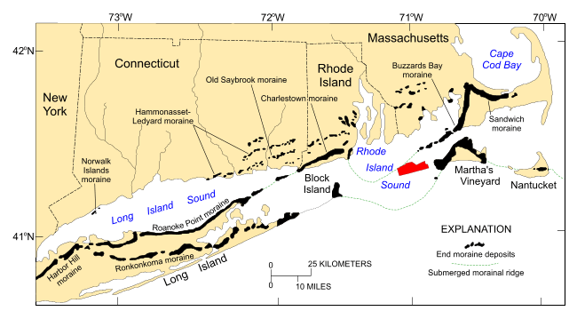
Figure 2. Map, modified from Stone and Borns (1986) and Gustavson and Boothroyd (1987), showing locations of end moraines (black polygons) in southern New England and on Long Island, New York. The Ronkonkoma-Nantucket moraine marks the Laurentide Ice Sheet's southern extent at glacial maximum about 20-24 ka and the Harbor Hill-Roanoke Point-Charlestown-Buzzards Bay moraine represents ice sheet position after a readvance around 18 ka (Uchupi and others, 1996). Underwater extensions of the moraines are shown as dashed lines. Study area is shown as a red polygon. | ||


