Skip past header information
USGS - science for a changing world
NOAA Logo with link to NOAA Home Page.Massachusetts CZM Logo with link to MA CZM Home Page.  

U.S. Geological Survey Open-File Report 2011–1004

Sea-Floor Geology and Character of Eastern Rhode Island Sound West of Gay Head, Massachusetts


Skip past contents information

Title | List of Figures | Conversion Factors | Abstract | Introduction | Setting | Methods | Bathymetry | Sediment Distribution | Bottom Photography | GIS Data Catalog | Summary | Acknowledgments | References | Contacts


Figure 28. Map showing locations of sediment sample locations.

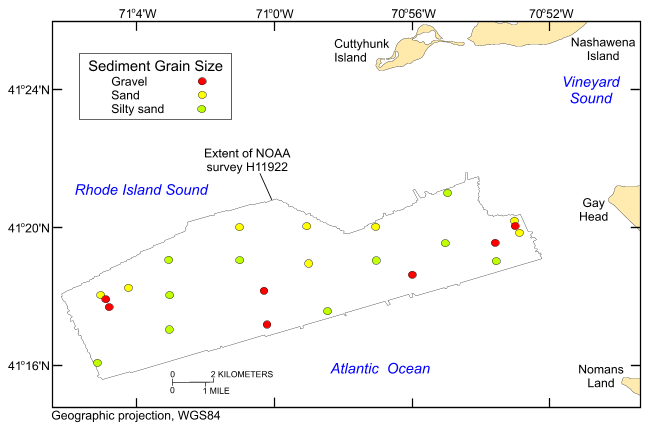
Figure 28. Map showing the station locations from U.S. Geological Survey cruises 2010-033-FA and 2010-005-FA, that were used to verify the acoustic data, color coded for sediment texture. Hotter colors are coarser grained sediment; cooler colors are finer grained sediments.

Skip USGS links group

Accessibility FOIA Privacy Policies and Notices

Take Pride in America logo USAGov logo U.S. Department of the Interior | U.S. Geological Survey
End of USGS links group