Skip past header information
USGS - science for a changing world
NOAA Logo with link to NOAA Home Page.Massachusetts CZM Logo with link to MA CZM Home Page.  

U.S. Geological Survey Open-File Report 2011–1004

Sea-Floor Geology and Character of Eastern Rhode Island Sound West of Gay Head, Massachusetts


Skip past contents information

Title | List of Figures | Conversion Factors | Abstract | Introduction | Setting | Methods | Bathymetry | Sediment Distribution | Bottom Photography | GIS Data Catalog | Summary | Acknowledgments | References | Contacts


Figure 29. Map showing sedimentary environments in the study area.

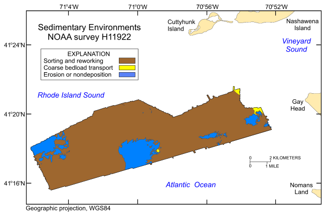
Figure 29. Distribution of sedimentary environments based on the digital terrain model from National Oceanic and Atmospheric Administration survey H11922 and the sampling and photography data from U.S. Geological Survey cruises 2010-033-FA and 2010-005-FA that were used to verify the acoustic data. Areas characterized by processes associated with erosion or nondeposition, coarse bedload transport, and sorting and reworking are shown.

Skip USGS links group

Accessibility FOIA Privacy Policies and Notices

Take Pride in America logo USAGov logo U.S. Department of the Interior | U.S. Geological Survey
End of USGS links group