Skip Links

USGS - science for a changing world

Open-File Report 2011–1039

Prepared in cooperation with the University of Delaware

Continuous Resistivity Profiling and Seismic-Reflection Data Collected in April 2010 From Indian River Bay, Delaware

By V.A. Cross, J.F. Bratton, H.A. Michael, K.D. Kroeger, Adrian Green, and Emile Bergeron

Thumbnail of and link to report PDF (10.4 MB)Abstract

A geophysical survey to delineate the fresh-saline groundwater interface and associated sub-bottom sedimentary structures beneath Indian River Bay, Delaware, was carried out in April 2010. This included surveying at higher spatial resolution in the vicinity of a study site at Holts Landing, where intensive onshore and offshore studies were subsequently completed. The total length of continuous resistivity profiling (CRP) survey lines was 145 kilometers (km), with 36 km of chirp seismic lines surveyed around the perimeter of the bay. Medium-resolution CRP surveying was performed using a 50-meter streamer in a baywide grid. Results of the surveying and data inversion showed the presence of many buried paleochannels beneath Indian River Bay that generally extended perpendicular from the shoreline in areas of modern tributaries, tidal creeks, and marshes. An especially wide and deep paleochannel system was imaged in the southeastern part of the bay near White Creek. Many paleochannels also had high-resistivity anomalies corresponding to low-salinity groundwater plumes associated with them, likely due to the presence of fine-grained estuarine mud and peats in the channel fills that act as submarine confining units. Where present, these units allow plumes of low-salinity groundwater that was recharged onshore to move beyond the shoreline, creating a complex fresh-saline groundwater interface in the subsurface. The properties of this interface are important considerations in construction of accurate coastal groundwater flow models. These models are required to help predict how nutrient-rich groundwater, recharged in agricultural watersheds such as this one, makes its way into coastal bays and impacts surface-water quality and estuarine ecosystems.

First posted August 11, 2014

For additional information, contact:
Director, Woods Hole Coastal and Marine Science Center
U.S. Geological Survey
384 Woods Hole Road
Quissett Campus
Woods Hole, MA 02543
http://woodshole.er.usgs.gov/

Part or all of this report is presented in Portable Document Format (PDF). For best results viewing and printing PDF documents, it is recommended that you download the documents to your computer and open them with Adobe Reader. PDF documents opened from your browser may not display or print as intended. Download the latest version of Adobe Reader, free of charge. More information about viewing, downloading, and printing report files can be found here.


Suggested citation:

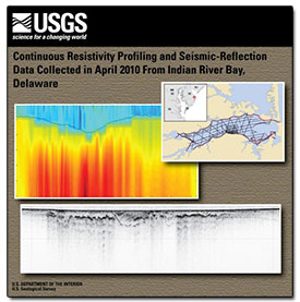
Cross, V.A., Bratton, J.F., Michael, H.A., Kroeger, K.D., Green, Adrian, and Bergeron, Emile, 2014, Continuous resistivity profiling and seismic-reflection data collected in April 2010 from Indian River Bay, Delaware: U.S. Geological Survey Open-File Report 2011–1039, 23 p., http://dx.doi.org/10.3133/ofr20111039.

ISSN 2331–1258 (online)


Contents

Acronyms and Abbreviations

Abstract

Introduction

Methods

Profile Previews

Summary

Data Catalog

Acknowledgments

References Cited

Glossary


Accessibility FOIA Privacy Policies and Notices

Take Pride in America logo USA.gov logo U.S. Department of the Interior | U.S. Geological Survey
URL: http://pubsdata.usgs.gov/pubs/of/2011/1039/index.html
Page Contact Information: GS Pubs Web Contact
Page Last Modified: Monday, 11-Aug-2014 14:46:52 EDT