 Abstract Abstract
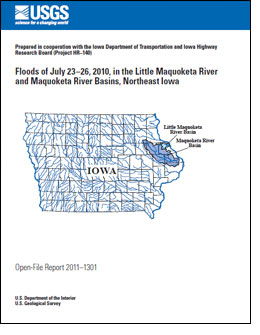
Minor flooding occurred July 23, 2010, in the Little Maquoketa River Basin and major flooding occurred
July 23–26, 2010, in the Maquoketa River Basin in northeast
Iowa following severe thunderstorm activity over the
region during July 22–24. A breach of the Lake Delhi Dam
on July 24 aggravated flooding on the Maquoketa River. Rain
gages at Manchester and Strawberry Point, Iowa, recorded
72-hour-rainfall amounts of 7.33 and 12.23 inches, respectively,
on July 24. The majority of the rainfall occurred during
a 48-hour period. Within the Little Maquoketa River Basin,
a peak-discharge estimate of 19,000 cubic feet per second
(annual flood-probability estimate of 4 to 10 percent) at the
discontinued 05414500 Little Maquoketa River near Durango,
Iowa streamgage on July 23 is the sixth largest flood on
record. Within the Maquoketa River Basin, peak discharges
of 26,600 cubic feet per second (annual flood-probability estimate
of 0.2 to 1 percent) at the 05416900 Maquoketa River at
Manchester, Iowa streamgage on July 24, and of 25,000 cubic
feet per second (annual flood-probability estimate of 1 to
2 percent) at the 05418400 North Fork Maquoketa River near
Fulton, Iowa streamgage on July 24 are the largest floods on
record for these sites. A peak discharge affected by the Lake
Delhi Dam breach on July 24 at the 05418500 Maquoketa
River near Maquoketa, Iowa streamgage, located downstream
of Lake Delhi, of 46,000 cubic feet per second on July 26 is
the third highest on record.
High-water marks were measured at five locations along
the Little Maquoketa and North Fork Little Maquoketa Rivers
between U.S. Highway 52 near Dubuque and County Road
Y21 near Rickardsville, a distance of 19 river miles. Highwater
marks were measured at 28 locations along the Maquoketa
River between U.S. Highway 52 near Green Island and
State Highway 187 near Arlington, a distance of 142 river
miles. High-water marks were measured at 13 locations along
the North Fork Maquoketa River between Rockdale Road near
Maquoketa and U.S. Highway 52 near Luxemburg, a distance
of 90 river miles. The high-water marks were used to develop
flood profiles for the Little Maquoketa, North Fork Little
Maquoketa, Maquoketa, and North Fork Maquoketa Rivers.
|
First posted January 19, 2012
Part or all of this report is presented in Portable Document Format (PDF); the latest version of Adobe Reader or similar software is required to view it. Download the latest version of Adobe Reader, free of charge. |

