U.S. Geological Survey Open-File Report 2012–1005
Sea-Floor Character and Sedimentary Processes of Block Island Sound, Offshore Rhode Island
 |
||
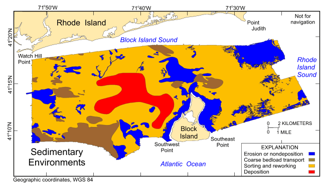
Figure 38. Distribution of sedimentary environments based on the digital terrain model from combined National Oceanic and Atmospheric Administration (NOAA) surveys H12009, H12010, H12011, H12015, H12033, H12137, and H12139; unpublished NOAA survey H12299 located adjacent to the southwestern corner of the (DTM); and the sampling and photography data from U.S. Geological Survey cruise 2011-006-FA that were used to verify the acoustic data. Areas characterized by processes associated with erosion or nondeposition, coarse bedload transport, sorting and reworking, and deposition are shown. |
||

![]() U.S. Department of the Interior |
U.S. Geological Survey
U.S. Department of the Interior |
U.S. Geological Survey
URL: http://pubsdata.usgs.gov/pubs/of/2012/1005_p/html/fig38.html
Page Contact Information: GS Pubs Web Contact
Page Last Modified: Tuesday, 22-Jul-2014 11:19:12 EDT

