Skip Links

USGS - science for a changing world

Open-File Report 2012–1202

Prepared in cooperation with the Iowa Department of Transportation and Iowa Highway Research Board (Project HR-140)

Flood of August 11–16, 2010, in the South Skunk River Basin, Central and Southeast Iowa

By Kimberlee K. Barnes and David A. Eash

Thumbnail of and link to report PDF (2.03 MB)Abstract

Severe thunderstorm activity during August 8–11, 2010 in central and southeast Iowa resulted in major flooding from August 11–16, 2010, in the South Skunk River Basin. Rain gages at Ames and Story City recorded 96-hour rainfall amounts of 9.61 and 8.70 inches, respectively. The majority of the rainfall occurred during a 52-hour period, beginning late at night on August 8. Within the South Skunk River Basin, peak discharges of 14,800 cubic feet per second (annual flood-probability estimate of 0.2 to 1 percent) at the 05470000 South Skunk River near Ames, Iowa streamgage; of 36,200 cubic feet per second (annual flood-probability estimate of less than 0.2 percent) at the 05471000 South Skunk River below Squaw Creek near Ames, Iowa streamgage (both on August 11, 2010); and of 24,000 cubic feet per second (annual flood-probability estimate of 0.2 to 1 percent) at 05471050 South Skunk River at Colfax, Iowa streamgage on August 14 are the largest floods on record for these sites. Peak discharges at 05470500 Squaw Creek at Ames, Iowa streamgage of 22,400 cubic feet per second (annual flood-probability estimate of less than 0.2 percent) on August 11; and at 05471500 South Skunk River near Oskaloosa, Iowa streamgage, of 25,200 cubic feet per second (annual flood- probability estimate of 1 to 2 percent) on August 16 are the second highest floods on record. This report provides a description of the watershed, the thunderstorms, the flooding, and a profile of high-water marks measured at 20 locations along the South Skunk River between County Road V67/280th Avenue, northeast of Ollie in Keokuk County and West Riverside Road in Ames, a distance of 128 river miles.

First posted October 31, 2012

For additional information contact:
Director, Iowa Water Science Center
U.S. Geological Survey
P.O. Box 1230
Iowa City, IA 52244
http://ia.water.usgs.gov

Part or all of this report is presented in Portable Document Format (PDF); the latest version of Adobe Reader or similar software is required to view it. Download the latest version of Adobe Reader, free of charge.


Suggested citation:

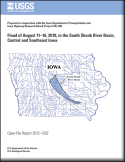
Barnes, K.K., and Eash, D.A., 2012, Flood of August 11–16, 2010, in the South Skunk River Basin, central and southeast Iowa: U.S. Geological Survey Open-File Report 2012–1202, 27 p. with appendix.


Contents

Acknowledgments

Abstract

Introduction

Annual Flood Probability

Flood History

Flood of August 11–16, 2010

Flood Profile

Summary

References Cited

Appendix. List of Bench Marks and Reference Points


Accessibility FOIA Privacy Policies and Notices

Take Pride in America logo USA.gov logo U.S. Department of the Interior | U.S. Geological Survey
URL: http://pubsdata.usgs.gov/pubs/of/2012/1202/index.html
Page Contact Information: GS Pubs Web Contact
Page Last Modified: Saturday, 12-Jan-2013 15:31:24 EST