Open-File Report 2013–1032
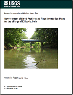
IntroductionDigital flood-inundation maps for a reach of Killbuck Creek near the Village of Killbuck, Ohio, were created by the U.S. Geological Survey (USGS), in cooperation with Holmes County, Ohio. The inundation maps depict estimates of the areal extent of flooding corresponding to water levels (stages) at the USGS streamgage Killbuck Creek near Killbuck (03139000) and were completed as part of an update to Federal Emergency Management Agency Flood-Insurance Study. The maps were provided to the National Weather Service (NWS) for incorporation into a Web-based flood-warning system that can be used in conjunction with NWS flood-forecast data to show areas of predicted flood inundation associated with forecasted flood-peak stages. The digital maps also have been submitted for inclusion in the data libraries of the USGS interactive Flood Inundation Mapper. Data from the streamgage can be used by emergency-management personnel, in conjunction with the flood-inundation maps, to help determine a course of action when flooding is imminent. Flood profiles for selected reaches were prepared by calibrating a steady-state step-backwater model to an established streamgage rating curve. The step-backwater model then was used to determine water-surface-elevation profiles for 10 flood stages at the streamgage with corresponding streamflows ranging from approximately the 50- to 0.2-percent annual exceedance probabilities. The computed flood profiles were used in combination with digital elevation data to delineate flood-inundation areas. |
First posted February 20, 2013
For additional information contact: Part or all of this report is presented in Portable Document Format (PDF); the latest version of Adobe Reader or similar software is required to view it. Download the latest version of Adobe Reader, free of charge. |
Ostheimer, C.J., 2013, Development of flood profiles and flood-inundation maps for the Village of Killbuck, Ohio: U.S. Geological Survey Open-File Report 2013–1032, 8 p., available only at http://pubs.usgs.gov/of/2013/1032/.
Abstract
Introduction
Hydrologic Analyses
Hydraulic Modeling
Summary
References Cited

![]() U.S. Department of the Interior |
U.S. Geological Survey
U.S. Department of the Interior |
U.S. Geological Survey
URL: http://pubsdata.usgs.gov/pubs/of/2013/1032/index.html
Page Contact Information: GS Pubs Web Contact
Page Last Modified: Wednesday, 20-Feb-2013 14:31:46 EST
