Skip Links

USGS - science for a changing world

Open-File Report 2013–1125

Prepared in cooperation with the National Oceanic and Atmospheric Administration

Bathymetric Terrain Model of the Puerto Rico Trench and the Northeastern Caribbean Region for Marine Geological Investigations

By Brian D. Andrews, Uri S. ten Brink, William W. Danforth, Jason D. Chaytor, José-Luis Granja Bruña, Pilar Llanes Estrada, and Andrés Carbó-Gorosabel

Thumbnail of and link to report PDF (1.51 MB)Abstract

Multibeam bathymetric data collected in the Puerto Rico Trench and northeastern Caribbean region are compiled into a seamless bathymetric terrain model for broad-scale geological investigations of the trench system. These data, collected during eight separate surveys between 2002 and 2013 and covering almost 180,000 square kilometers, are published here in large-format map sheet and digital spatial data. This report describes the common multibeam data collection and processing methods used to produce the bathymetric terrain model and corresponding data-source polygon. Details documenting the complete provenance of the data are provided in the metadata in the Data Catalog section.

First posted November 12, 2014

  • Plate PDF (79.2 MB)
    Bathymetric Terrain Model of the Puerto Rico Trench and the Northeastern Caribbean Region for Marine Geological Investigations

For additional information, contact:
Director, Woods Hole Coastal and Marine Science Center
U.S. Geological Survey
384 Woods Hole Road
Quissett Campus
Woods Hole, MA 02543
(508) 548-8700
http://woodshole.er.usgs.gov

Part or all of this report is presented in Portable Document Format (PDF). For best results viewing and printing PDF documents, it is recommended that you download the documents to your computer and open them with Adobe Reader. PDF documents opened from your browser may not display or print as intended. Download the latest version of Adobe Reader, free of charge. More information about viewing, downloading, and printing report files can be found here.


Suggested citation:

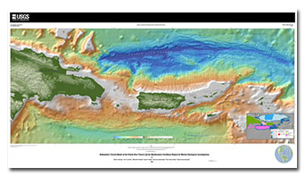
Andrews, B.D., ten Brink, U.S., Danforth, W.W., Chaytor, J.D., Granja Bruña, José-Luis, Llanes Estrada, Pilar, and Carbó-Gorosabel, Andrés, 2014, Bathymetric terrain model of the Puerto Rico trench and the northeastern Caribbean region for marine geological investigations: U.S. Geological Survey Open-File Report 2013–1125, 10 p., 1 pl., http://dx.doi.org/10.3133/ofr20131125.

ISSN 2331-1258 (online)


Contents

Acknowledgments

Abstract

Introduction

Multibeam Data

Common Processing Methods

Data Catalog

Map Sheet

References Cited


Accessibility FOIA Privacy Policies and Notices

Take Pride in America logo USA.gov logo U.S. Department of the Interior | U.S. Geological Survey
URL: http://pubsdata.usgs.gov/pubs/of/2013/1125/index.html
Page Contact Information: GS Pubs Web Contact
Page Last Modified: Wednesday, 12-Nov-2014 10:43:37 EST