 Abstract Abstract
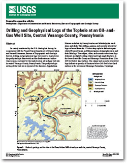
In a study conducted by the U.S. Geological Survey, in cooperation with the Pennsylvania Department of Conservation and Natural Resources, Bureau of Topographic and Geologic Survey, drilling and geophysical logs were used to characterize the geohydrologic framework and the freshwater and saline-water zones penetrated by the tophole at an oil-and-gas well site in central Venango County, Pennsylvania. The geohydrologic setting of the well site is typical of the dissected Appalachian Plateau underlain by Pennsylvanian and Mississippian sandstone and shale. The drilling, gamma, and acoustic-televiewer logs collected from the 575-foot deep tophole define the penetrated Pennsylvanian and Mississippian stratigraphic units and their lithology. The caliper, video, and acoustic-televiewer logs delineate multiple bedding-related and high-angle fractures in the lower Pottsville Group and Shenango Formation from 22 to 249 feet below land surface. The caliper and acoustic-televiewer logs indicate a sparsity of fractures below 249 feet below land surface in the lowermost Shenango Formation, Cuyahoga Group, Corry Sandstone, “Drake Well” formation, and upper Riceville Formation.
About half of the blown yield during drilling of the tophole was from fractures in the upper Shenango Formation between 80 and 167 feet below land surface and the other half from fractures in the lower Shenango between 190 and 249 feet below land surface. Following drilling, fractures above the water level at about 145 feet below land surface produced freshwater with a specific conductance of less than 150 microsiemens per centimeter at 25 degrees Celsius that cascaded down the hole. As indicated by the fluid resistivity and temperature logs, most of the downflow exited the hole at the water-bearing fractures at 249 feet below land surface. The downward flow in the tophole reflects the downward hydraulic gradient between the water-bearing fractures above the water level and those at 249 feet below land surface.
Low conductivity and high resistivity values on the dual induction logs indicate freshwater above 285 feet below land surface in the Shenango sandstones, which is consistent with a specific conductance of blown yield of 400 microsiemens per centimeter at 25 degrees Celsius at 200 feet below land surface. High conductivity and low resistivity values on the induction logs indicate the presence of saline water below 450 feet in the Corry Sandstone. The highest specific conductance of the blown yield, 1,200 microsiemens per centimeter at 25 degrees Celsius, was measured at 480 feet below land surface following penetration of the Corry Sandstone.
Collection and integrated analysis of drilling and geophysical logs provided an efficient and effective means for characterizing the geohydrologic framework and conditions penetrated by the tophole at the selected oil-and-gas well site. The logging methods and lessons learned at this well site could be applied at other oil-and-gas drilling sites to better characterize the shallow subsurface with the overall goal of protecting freshwater aquifers during hydrocarbon development.
|
First posted December 4, 2014
Part or all of this report is presented in Portable Document Format (PDF). For best results viewing and printing PDF documents, it is recommended that you download the documents to your computer and open them with Adobe Reader. PDF documents opened from your browser may not display or print as intended. Download the latest version of Adobe Reader, free of charge. More information about viewing, downloading, and printing report files can be found here.
|

