Online Links:
Online Links:
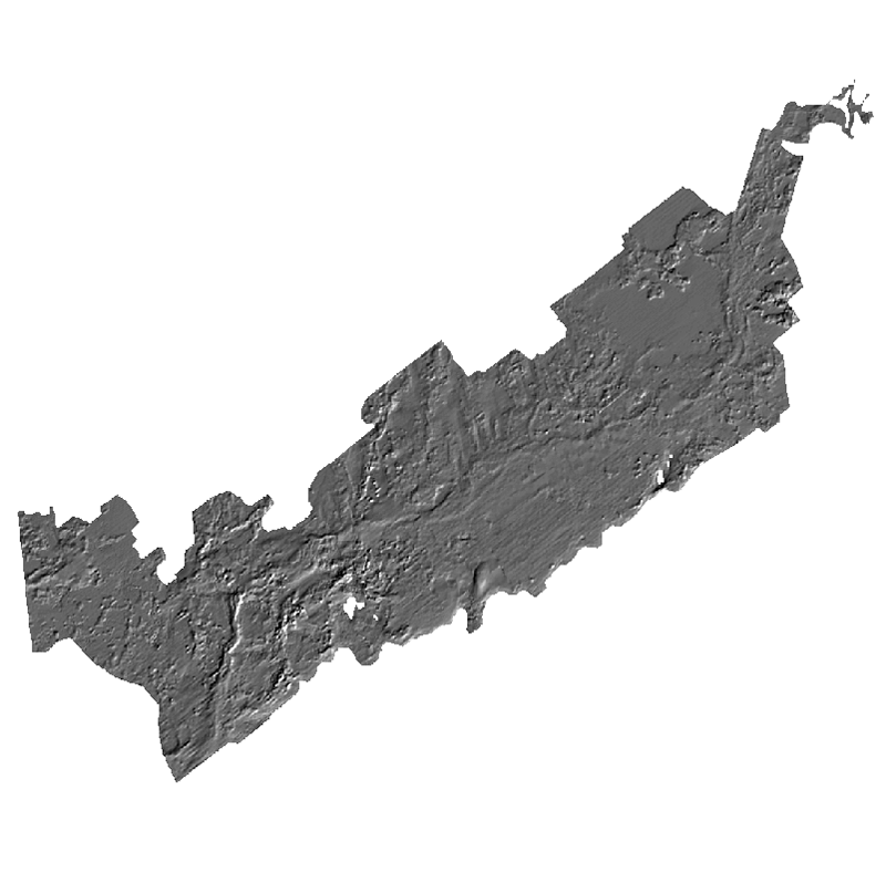
This data set contains a hillshaded image representing the depth to the top of glacial deposits. These data are useful for assessing relations between geologic framework and sea-bed morphology. The top of the glacial deposit surface is defined by the Ur/Ut unconformity. The late Wsconsinan regressive unconformity (Ur) and where Ur merges with the Holocene transgressive unconformity (Ut) defines the upper surface of glacial deposits.
Online Links:
Online Links:
Online Links:
Online Links:
Online Links:
Online Links:
Are there legal restrictions on access or use of the data?
- Access_Constraints: None
- Use_Constraints:
- Not to be used for navigation. Public domain data from the U.S. Government are freely redistributable with proper metadata and source attribution. Please recognize the U.S. Geological Survey (USGS) as the source of this information.
Neither the U.S. Government, the Department of the Interior, nor the USGS, nor any of their employees, contractors, or subcontractors, make any warranty, express or implied, nor assume any legal liability or responsibility for the accuracy, completeness, or usefulness of any information, apparatus, product, or process disclosed, nor represent that its use would not infringe on privately owned rights. The act of distribution shall not constitute any such warranty, and no responsibility is assumed by the U.S. Geological Survey in the use of these data or related materials. Any use of trade, product, or firm names is for descriptive purposes only and does not imply endorsement by the U.S. Government
| Data format: | WinZip v. 14.5 file contains an Esri GeoTIFF (and associated metadata) that defines the hillshade-relief image of the late-Wisconsinan regressive unconformity beneath Buzzards Bay, Massachusetts in format GeoTIFF (version ArcMap 9.3.1) raster image Size: 0.2 |
|---|---|
| Network links: |
https://pubs.usgs.gov/of/2014/1220/GIS_catalog/Stratigraphy/Ur/Urelevhs.zip https://pubs.usgs.gov/of/2014/1220/ofr2014-1220-data_catalog.html https://dx.doi.org/10.3133/ofr20141220 |
The GeoTiff contained in the zip file is available as an Esri GeoTIFF. To utilize this data, the user must have a GIS software package capable of reading GeoTIFF.