Skip Links

USGS - science for a changing world

Open-File Report 2015–1047

Prepared in cooperation with the Trinity River Restoration Program

Geomorphic Mapping to Support River Restoration on the Trinity River Downstream from Lewiston Dam, California, 1980–2011

By Jennifer A. Curtis and Timothy M. Guerrero

Thumbnail of and link to report PDF (6.8 MB)Abstract

Historic land use, dam construction, water storage, and flow diversions in the Trinity River watershed have resulted in downstream geomorphic change, loss of salmonid habitat, and declines in salmonid populations. The USGS in cooperation with the Trinity River Restoration Program, a multi-agency partnership tasked with implementing federally mandated restoration, completed a geomorphic change assessment to inform the planning process for future restoration work. This report documents an ARCMAP geodatabase (v.10.0) containing geomorphic features digitized from a series of rectified orthophotographs (https://dx.doi.org/10.5066/F7TT4P04). Upland, riparian, and channel features were digitized from six available base images (1980, 1997, 2001, 2006, 2009, and 2011). This report describes the structure of the geodatabase and the methods used to delineate individual geomorphic features.

First posted May 13, 2015

Database of Geomorphic Features

  • Scientific Investigations Report 2015–5046
    Curtis, J.A., Wright, S.A., Minear, J.T., and Flint, L.E., 2015, Assessing geomorphic change along the Trinity River downstream from Lewiston Dam, California, 1980–2011: U.S. Geological Survey Scientific Investigations Report 2015–5046, 69 p., plus appendix, https://dx.doi.org/10.3133/sir20155046.

For additional information, contact:
Director, California Water Science Center
U.S. Geological Survey
6000 J Street, Placer Hall
Sacramento, California 95819
http://ca.water.usgs.gov

Part or all of this report is presented in Portable Document Format (PDF). For best results viewing and printing PDF documents, it is recommended that you download the documents to your computer and open them with Adobe Reader. PDF documents opened from your browser may not display or print as intended. Download the latest version of Adobe Reader, free of charge. More information about viewing, downloading, and printing report files can be found here.


Suggested citation:

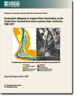
Curtis, J.A., and Guerrero, T.M., 2015, Geomorphic mapping to support river restoration on the Trinity River downstream from Lewiston Dam, California, 1980–2011: U.S. Geological Survey Open-File Report 2015–1047, 15 p., https://dx.doi.org/10.3133/ofr20151047.

ISSN 2331-1258 (online)


Contents

Abstract

Introduction

Purpose and Scope

Study Area

Geomorphic Mapping Geodatabase

References Cited


Accessibility FOIA Privacy Policies and Notices

Take Pride in America logo USA.gov logo U.S. Department of the Interior | U.S. Geological Survey
URL: http://pubsdata.usgs.gov/pubs/of/2015/1047/index.html
Page Contact Information: GS Pubs Web Contact
Page Last Modified: Wednesday, 07-Dec-2016 21:42:34 EST