Skip Links

USGS - science for a changing world

Open-File Report 2015–1122

Trench Logs, Terrestrial Lidar System Imagery, and Radiocarbon Data from the Kilometer-62 Site On the Greenville Fault, Southeastern Alameda County, California, 2014

By James J. Lienkaemper, Stephen B. DeLong, Nikita N. Avdievitch, Alexandra Pickering, and Thomas P. Guilderson

Thumbnail of and link to report PDF (3.8 MB)Summary

In 2014, we investigated an abrupt 8.5-meter (m), right-laterally deflected stream channel located near the Greenville Fault in southeastern Alameda County, California (-121.56224° E, 37.53430° N) that we discovered using 0.5-m resolution, 2011 aerial lidar imagery flown along the active fault trace. Prior to trenching we surveyed the site using a terrestrial lidar system (TLS) to document the exact geomorphic expression of this deflected stream channel before excavating a trench adjacent to it. We trenched perpendicular to the fault hoping to document the prehistoric history of earthquake ruptures along the fault. However, the alluvial stratigraphy that we document in these trench logs shows conclusively that this trench did not expose any active fault trace. Using other local geomorphic evidence for the fault location, a straight fault scarp immediately north of this stream projects slightly upslope of the west end of our trench and may be the actual location of the active fault trace. Five radiocarbon samples establish age control for the alluvial sequence documented in the trench, which may in the future be useful in constraining the long-term slip rate of the Greenville Fault. The deflection had been caused by an abrupt nontectonic termination of unit u30, a relatively thick (0.15–0.35 m) silt that is more erosion resistant than the adjacent cohesionless sand and gravel. 

First posted June 30, 2015

This publication is online only

For additional information, contact:
Contact Information, Menlo Park, Calif.
Office—Earthquake Science Center
U.S. Geological Survey
345 Middlefield Road, MS 977
Menlo Park, CA 94025-3591
http://earthquake.usgs.gov/

Part or all of this report is presented in Portable Document Format (PDF). For best results viewing and printing PDF documents, it is recommended that you download the documents to your computer and open them with Adobe Reader. PDF documents opened from your browser may not display or print as intended. Download the latest version of Adobe Reader, free of charge. More information about viewing, downloading, and printing report files can be found here.


Suggested citation:

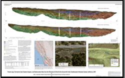
Lienkaemper, J.J., DeLong, S.B., Avdievitch, N.N., Pickering, A., and Guilderson, T.P., 2015, Trench logs, terrestrial lidar system Imagery and radiocarbon data from the Kilometer-62 Site on the Greenville Fault, southeastern Alameda County, California, 2014: U.S. Geological Survey Open-File Report 2015–1122, https://dx.doi.org/10.3133/ofr20151122.

ISSN 2331-1258 (online)


Accessibility FOIA Privacy Policies and Notices

Take Pride in America logo USA.gov logo U.S. Department of the Interior | U.S. Geological Survey
URL: http://pubsdata.usgs.gov/pubs/of/2015/1122/index.html
Page Contact Information: GS Pubs Web Contact
Page Last Modified: Wednesday, 07-Dec-2016 21:43:01 EST