
What role can geoscience information play in the assessment of risk and the value of insurance, especially for natural hazard type risks? In an earlier, related paper Ganderton and others (2000) provided subjects with relatively simple geoscience information concerning natural hazard-type risks. Their research looked at how subjects purchase insurance when faced with relatively low probability but high loss risks of the kind that characterize natural hazards and now, increasingly, manmade disasters. They found evidence to support the expected utility theory (definitions of economics terms can be found in a glossary at the end of report), yet there remained the implication that subjects with excessive aversion to risk were willing to pay considerably more for insurance than the actuarially fair price plus any reasonable risk premium. Here, we report the results of additional experiments that provide further support for the basic postulates of expected utility theory. However, these new experiments add considerably to the decision environment facing subjects by offering an option to purchase geoscientific information that would assist them when calculating expected losses from hazards more accurately.
Using an Internet-based mechanism to present information and gather data in an experimental setting, this research provided subjects with considerable textual and graphical information, and time to process it. Over a period of three months, almost 400 subjects participated in on-line experiments that generated approximately 22,000 usable data points for the empirical analysis discussed in this report.
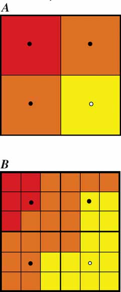
In the design of the experiment, we modeled the decisions to purchase (1) a detailed map giving subjects more information regarding the distribution of losses from a hazard and (2) insurance to indemnify them from any losses should they occur. On the basis of this design, we find strong evidence in support of the expected utility theory. Many of the findings reinforce those found in the early, similar study (Ganderton and others, 2000). However, this research also finds interactions between the decision to become better informed and the decision to insure. We chose an empirical framework that allows for both explicit and implicit (unobservable) correlations between the two decisions. The results suggest that at the end of the computer game subjects recognize the benefits of greater geoscience information. They take advantage of it, but are sensitive to its cost. When subjects use the more detailed information, they are more likely to purchase insurance when it offers a net benefit.
Download this report as a 34-page PDF file (pp1683.pdf; 2 MB).
For questions about the scientific content of this report, please contact Rich Bernknopf
Suggested citation and version history
Download a free copy of the latest version of Adobe Reader.
|
Help |
PDF help |
Publications main page |
| Western Professional Papers |
| Geography | Western Geographic Science Center
This report is also available in print from:
USGS Information Services, Box 25286,
Federal Center, Denver, CO 80225
telephone: 888 ASK-USGS; e-mail: infoservices@usgs.gov

![]() U.S. Department of the Interior | U.S. Geological Survey
U.S. Department of the Interior | U.S. Geological Survey
URL: https://pubs.usgs.gov/pp/1683/
Page Contact Information: Michael Diggles
Created November 25, 2003 (cad)
Page Last Modified: June 16, 2008 (mfd)