Professional Paper 1766
Executive Summary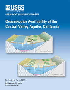
California’s Central Valley covers about 20,000 square miles and is one of the most productive agricultural regions in the world. More than 250 different crops are grown in the Central Valley with an estimated value of $17 billion per year. This irrigated agriculture relies heavily on surface-water diversions and groundwater pumpage. Approximately one-sixth of the Nation’s irrigated land is in the Central Valley, and about one-fifth of the Nation’s groundwater demand is supplied from its aquifers. The Central Valley also is rapidly becoming an important area for California’s expanding urban population. Since 1980, the population of the Central Valley has nearly doubled from 2 million to 3.8 million people. The Census Bureau projects that the Central Valley’s population will increase to 6 million people by 2020. This surge in population has increased the competition for water resources within the Central Valley and statewide, which likely will be exacerbated by anticipated reductions in deliveries of Colorado River water to southern California. In response to this competition for water, a number of water-related issues have gained prominence: conservation of agricultural land, conjunctive use, artificial recharge, hydrologic implications of land-use change, and effects of climate variability. To provide information to stakeholders addressing these issues, the USGS Groundwater Resources Program made a detailed assessment of groundwater availability of the Central Valley aquifer system, that includes: (1) the present status of groundwater resources; (2) how these resources have changed over time; and (3) tools to assess system responses to stresses from future human uses and climate variability and change. This effort builds on previous investigations, such as the USGS Central Valley Regional Aquifer System and Analysis (CV-RASA) project and several other groundwater studies in the Valley completed by Federal, State and local agencies at differing scales. The principal product of this new assessment is a tool referred to as the Central Valley Hydrologic Model (CVHM) that accounts for integrated, variable water supply and demand, and simulates surface-water and groundwater-flow across the entire Central Valley system. The development of the CVHM comprised four major elements: (1) a comprehensive Geographic Information System (GIS) to compile, analyze and visualize data; (2) a texture model to characterize the aquifer system;(3) estimates of water-budget components by numerically modeling the hydrologic system with the Farm Process (FMP); and (4) simulations to assess and quantify hydrologic conditions. |
For additional information contact: Part or all of this report is presented in Portable Document Format (PDF); the latest version of Adobe Reader or similar software is required to view it. Download the latest version of Adobe Reader, free of charge. |
Faunt, C.C., ed., 2009, Groundwater Availability of the Central Valley Aquifer, California: U.S. Geological Survey Professional Paper 1766, 225 p.
Chapter A: Introduction, Overview of Hydrogeology, and Textural Model of California’s Central Valley. By Claudia C. Faunt, Randall T. Hanson, and Kenneth Belitz
Executive Summary
Introduction
Study Area
Geologic History and Setting
Hydrogeology
Acknowledgments
References Cited
Chapter B: Groundwater Availability in California’s Central Valley. By Claudia C. Faunt, Kenneth Belitz, and Randall T. Hanson
Introduction
Development and the Hydrologic System
Development and Changes to the Hydrologic Budget
Global Climate Change and Variability
Groundwater Sustainability and Management
Monitoring the Hydrologic System
Summary
References Cited
Chapter C: Numerical Model of the Hydrologic Landscape and Groundwater Flow in California’s Central Valley. By Claudia C. Faunt, Randall T. Hanson, Kenneth Belitz, Wolfgang Schmid, Steven P. Predmore, Diane L. Rewis, and Kelly McPherson
Introduction
Model Development
Model Calibration and Sensitivity
Simulation Results and Budget
Model Uncertainty and Limitations
Future Work
References Cited
Appendix 1: Supplemental Information—Modifications to Modflow-2000 Packages and Processes. By Wolfgang Schmid and R.T. Hanson
Introduction
Layer-Property Flow Package (LPF)
Multiplier Package (MULT)
Time-Series Package (HYDMOD)
Streamflow Routing Package (SFR1)
The Farm Process (FMP1)
References Cited

![]() U.S. Department of the Interior |
U.S. Geological Survey
U.S. Department of the Interior |
U.S. Geological Survey
URL: http://pubsdata.usgs.gov/pubs/pp/1766/index.html
Page Contact Information: GS Pubs Web Contact
Page Last Modified: Thursday, 19-Oct-2017 15:09:07 EDT
