U.S. Geological Survey Professional Paper 1788
Click on the name of the benchmark to see the benchmark description in PDF form.
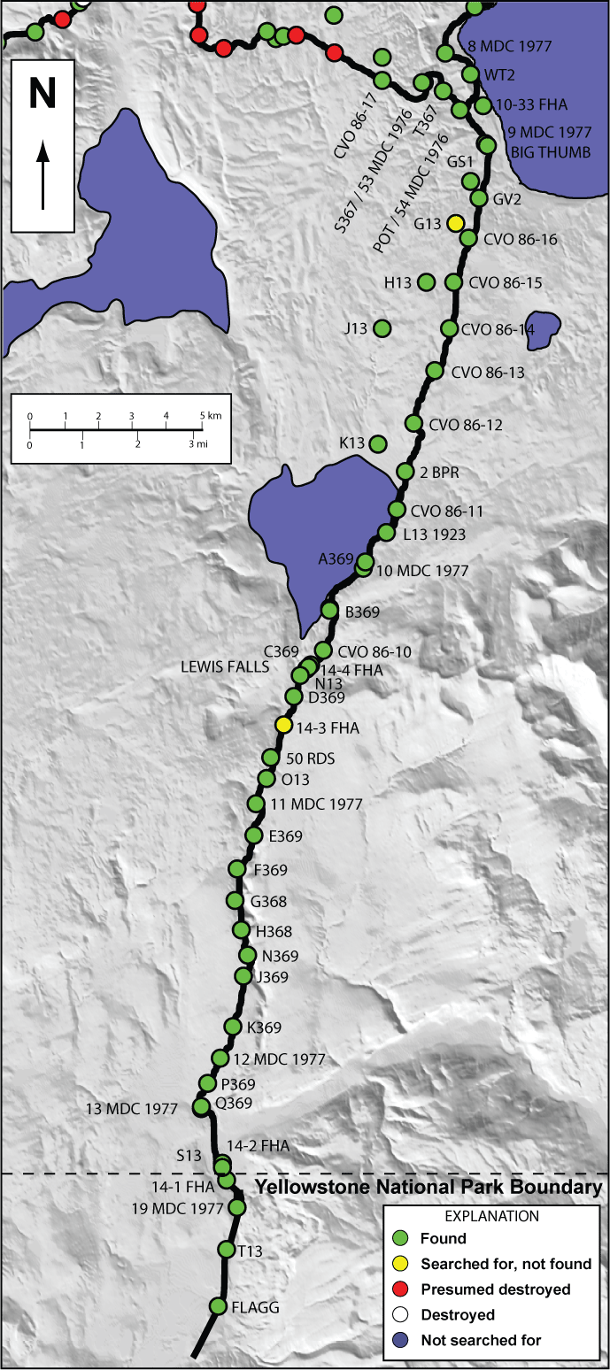
Map of Yellowstone Benchmarks
List of Yellowstone Benchmarks
Back to Yellowstone National Park Benchmark Database
Back to USGS Professional Paper 1788
Web-site design and database compilation by Megan McLay, USGS, CVO, Vancouver Wash. Address all inquiries to Dan Dzurisin (dzurisin@usgs.gov).

![]() U.S. Department of the Interior |
U.S. Geological Survey
U.S. Department of the Interior |
U.S. Geological Survey
URL: http://pubsdata.usgs.gov/pubs/pp/1788/pp1788_benchmarks/South-Entrance-map.html
Page Contact Information: GS Pubs Web Contact
Page Last Modified: Thursday, 01-Dec-2016 16:23:32 EST

