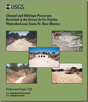
Professional Paper 1704
U.S. Geological Survey Professional Paper 1704, 63 pages (Published 2005)
By Allen C. Gellis, William W. Emmett, and Luna B. Leopold
Prepared in Cooperation with the New Mexico Environment Department
![]() This report is available online in pdf format: USGS PP 1704 (3 MB)
This report is available online in pdf format: USGS PP 1704 (3 MB)

Many of the original study sites were relocated and surveyed in the mid-1990's to determine subsequent channel and hillslope changes and to determine whether trends of channel and hillslope aggradation and degradation that were evident in the 1950's and 1960's have continued. In general, the net change in channel geometry has been small over the last 30ñ40 years. The average change in cross-sectional area of 32 resurveyed cross sections was erosion of 0.27 square meter, which equates to a 4-percent increase in cross-sectional area. The average net change in thalweg elevation for 51 resurveyed cross sections was degradation of 0.04 meter. Unpublished data (1964ñ68) from the scour chains showed that 371 chains had an average scour of 0.14 ± 0.14 meter and that 372 chains showed an average fill of 0.13 + 0.11 meter. Scour, found in the original study (1958ñ64) to be proportional to the square root of discharge, was confirmed with the addition of unpublished data (1964ñ68). The observed channel changes have no consistent trend, compared either to results observed in the original 1966 study or to distance from the watershed divide. The conclusion drawn in the original study was that most channels were aggrading; the resurvey showed that aggradation did not continue.
An increase in housing and population in the Arroyo de los Frijoles watershed since the 1950's has led to more roads. Channel degradation is most noticeable at road crossings. The greatest degradation of the main channel Arroyo de los Frijoles, 1.53 meters, and the greatest aggradation, 0.38 meter, occur downstream and upstream, respectively, from a culvert in a dirt road.
Periods of high average annual rainfall intensity reported for Santa Fe for 1853ñ80 immediately preceded late 19th century arroyo incision, and another period of high-intensity rainfall began in 1967. This may indicate that climatic factors are again favorable for arroyo incision in this part of New Mexico; data from this resurvey, however, do not provide evidence of a renewed cycle of erosion.
At a 1930's Civilian Conservation Corps-constructed dam on Coyote C. Arroyo, the measured sediment yield from 1966 to 1993 was 139 metric tonnes per square kilometer per year. Sediment yields have decreased through time because of either a decrease in the trap efficiency of the reservoir over time or a decrease in sediment delivery to the reservoir because of upstream channel storage. The effects of base-level rise on the channel profile were documented in 1993 through resurveys of sediment deposits behind two small dams, Big Sweat Dam and Little Sweat Dam. Both dams, built in 1960, showed sediment deposition that extends 20 and 9.3 meters upstream, respectively, and the 1993 sediment gradient was nearly the same as the unaffected channel upstream. Big Sweat Dam showed fluctuations in channel gradient within 5.3 meters of the dam, which may be a result of local scour following complete filling of the dam, scour from increased sinuosity, or differences in the location of surveying stations over time. The sinuosity of the channel has increased over time, presumably from a reduction in slope. Channel gradients 0 to 11.0 meters upstream from Little Sweat Dam have remained constant at about 0.028 from 1964 to 1993.
Measurement of erosion or hillslope-erosion plots show that average values of surface erosion range from 0.019 to 0.096 centimeters per year and are within values reported for regional erosion and denudation studies. Sediment yield from the Slopewash Tributary erosion plot was 307 metric tonnes per square kilometer per year.
The reproducibility and accuracy of the resurveys from the 1950's to the 1990's attest to the concepts used to quantify geomorphic features established in the Vigil Network. With relatively simple techniques, more than 30 years of geomorphic change were observed in this study.
Abstract
Introduction
Background
Study Area
Methods
Rainfall Data
Channel Cross-Sectional Surveys
Channel-Bed Scour and Fill
Deposition Behind Dams and Base-Level Experiments
Hillslope-Erosion Plots
Land Use
Rainfall Trends
Channel and Hillslope Processes
Channel Cross-Sectional Resurveys
Changes in Cross-Sectional Area
Changes in Thalweg Elevation
Changes in Gunshot Arroyo
Channel-Bed Scour and Fill
Deposition Behind Dams and Base-Level Experiments
Deposition Behind Dams
Base-Level Experiments
Hillslope-Erosion Plots
Changes in Land Use
Summary
Acknowledgments
References
![]() This report is available online in pdf format: USGS PP 1704 (3 MB)
This report is available online in pdf format: USGS PP 1704 (3 MB)
To view the PDF document, you need the Adobe Acrobat® Reader installed on your computer. (A free copy of the Acrobat® Reader may be downloaded from Adobe Systems Incorporated.)
Gellis, Allen C.; Emmett, William W.; Leopold, Luna B., 2005, Channel and Hillslope Processes Revisited in the Arroyo de los Frijoles Watershed near Santa Fe, New Mexico: U.S. Geological Survey Professional Paper 1704
[an error occurred while processing this directive]