FISC - St. Petersburg
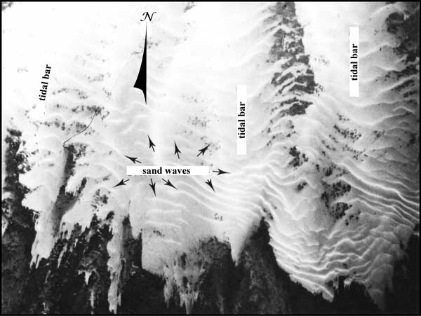
Figure 17. A pre-1990 aerial photo shows shallow, 1-m-high tidal bars and perpendicular sand waves near the west side of the Marquesas Keys in the Gulf of Mexico (from Shinn et al., 1990; Fig. 6A, Tile 11). Many of these sand waves are awash at spring low tide. Strong, reversing, north/south currents produce the sandbar orientations. Turtle sea grass (Thalassia testudinum) and various species of a calcareous green alga (Halimeda) populate the dark areas. Corals are absent. Distance across photo is approximately 2.5 km.
|
Can't see the printable PDF version? Get the free Adobe Acrobat® Reader. |

![]() U.S. Department of the Interior |
U.S. Geological Survey
U.S. Department of the Interior |
U.S. Geological Survey
URL: [disc] /pubs/pp/2007/1751/professional-paper/figures/fig17.html
Page Contact Information: Feedback
Page Last Modified: December 01, 2016 @ 04:11 PM (JSS)
