FISC - St. Petersburg
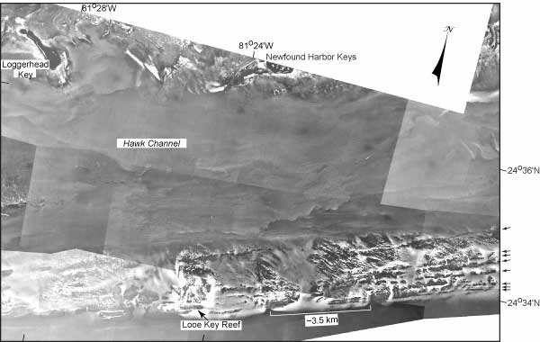
Figure 19. Sample mosaic of aerial photos (1975) shows seabed features seaward of the Newfound Harbor Keys (first islands north of Marker G on Fig. 6C, Tile 5, middle Keys). Arrows at right edge point to and show trend directions of the linear rock ridges or old reef lines visible on the outer shelf. These are believed to be narrow coral reefs separated by sediment-filled swales, such as have been cored near Marker G, located ~5 km northeast of Looe Key Reef.
|
Can't see the printable PDF version? Get the free Adobe Acrobat® Reader. |

![]() U.S. Department of the Interior |
U.S. Geological Survey
U.S. Department of the Interior |
U.S. Geological Survey
URL: [disc] /pubs/pp/2007/1751/professional-paper/figures/fig19.html
Page Contact Information: Feedback
Page Last Modified: December 01, 2016 @ 04:11 PM (JSS)
