FISC - St. Petersburg
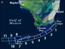
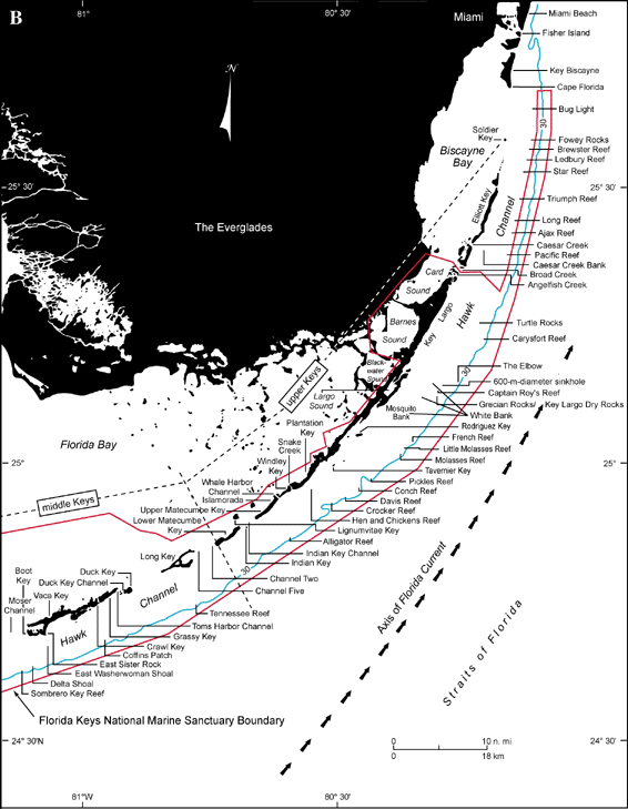
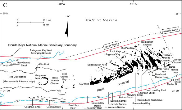
Figure 20. (A) Landsat satellite image of south Florida shows individual tile boundaries (blue rectangles) of this regional study in the Florida Keys National Marine Sanctuary. (B) Index map shows locations of named reefs and shoals in the upper Keys and northeastern middle Keys, delineated by dashed lines. (C) Index map shows locations of named reefs and shoals in the western middle and lower Keys, delineated by dashed lines. Most named reefs and shoals were once historic islands. Sanctuary boundary is in red; shelf margin is in blue. Contours are in meters.
|
Can't see the printable PDF version? Get the free Adobe Acrobat® Reader. |

![]() U.S. Department of the Interior |
U.S. Geological Survey
U.S. Department of the Interior |
U.S. Geological Survey
URL: [disc] /pubs/pp/2007/1751/professional-paper/figures/fig20.html
Page Contact Information: Feedback
Page Last Modified: December 01, 2016 @ 04:11 PM (JSS)
