FISC - St. Petersburg
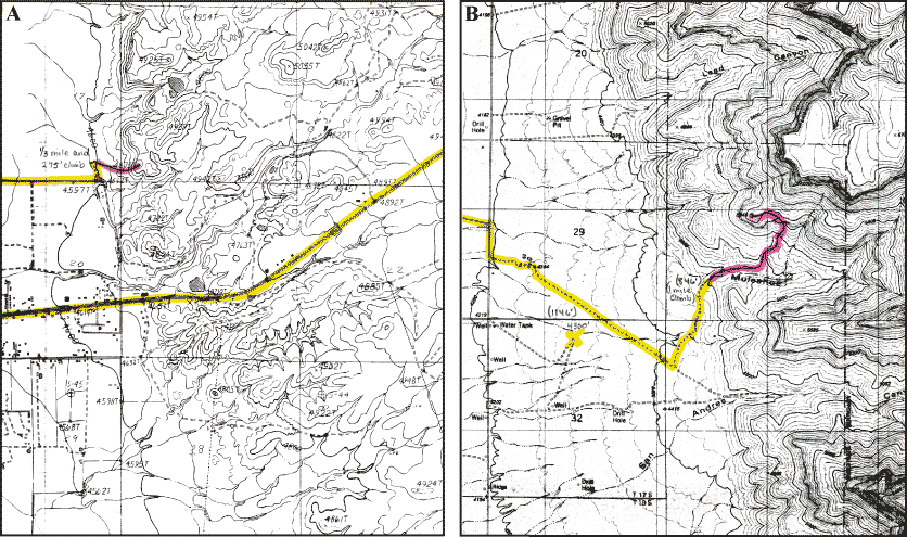
Figure 140. Topographic maps show approximate elevations above present sea level in areas of (A) Scorpion Mound and (B) Muleshoe Mound. Colors indicate routes traveled by car (yellow) and on foot (pink). The hike to Scorpion was ~0.5 km and the climb up ~84 m (1/3 mi and up 275 ft, the difference between the map-contour elevation at closest parking area and elevation at top of the mound). The hike to Muleshoe was ~1.6 km and the climb ~258 m (1 mi and up 846 ft). The crest of Muleshoe is about 100 m (328 ft) high.
|
Can't see the printable PDF version? Get the free Adobe Acrobat® Reader. |

![]() U.S. Department of the Interior |
U.S. Geological Survey
U.S. Department of the Interior |
U.S. Geological Survey
URL: [disc] /pubs/pp/2007/1751/professional-paper/summary/figures/fig140.html
Page Contact Information: Feedback
Page Last Modified: December 01, 2016 @ 04:12 PM (JSS)
