FISC - St. Petersburg
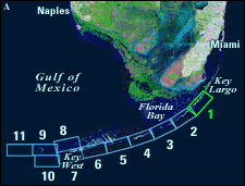
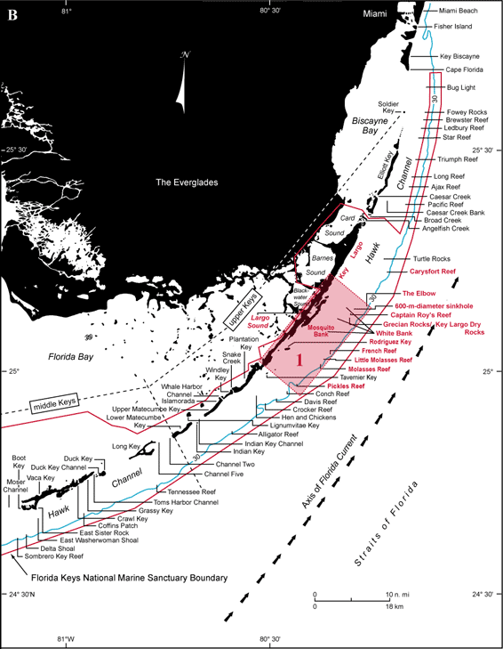
Figure 22. (A) Landsat satellite image of south Florida shows individual tile boundaries (blue rectangles) of this regional study in the Florida Keys National Marine Sanctuary. Tile 1 is highlighted. (B) Index map shows locations of named reefs and shoals in the upper Keys and northeastern middle Keys, delineated by dashed lines. Red rectangle shows geographic boundaries of Tile 1 with its geographic sites highlighted. Because of the amount of data available for the Carysfort Reef area, Carysfort Reef is discussed in the section for Tile 1. Sanctuary boundary is in red; shelf-margin contour (blue) is in meters.
|
Can't see the printable PDF version? Get the free Adobe Acrobat® Reader. |

