FISC - St. Petersburg
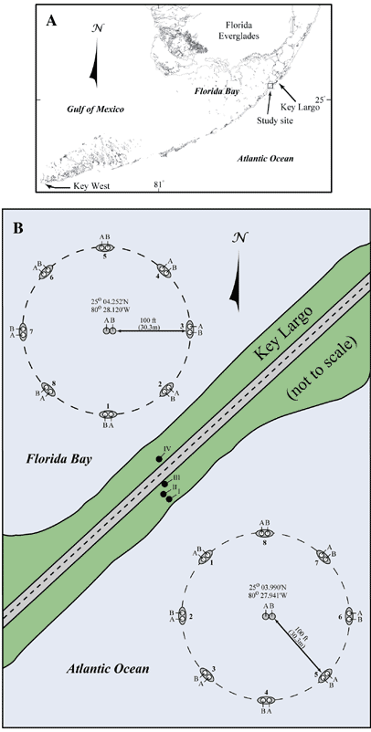
Figure 23. (A) Index map shows location of water-monitoring well study. (B) Diagram shows sites of groundwater-flow experiments off Key Largo and layout and position of well clusters in Florida Bay and the Atlantic Ocean (modified from Reich et al., 2002). Well clusters consist of nested, capped monitoring wells. Wells labeled 'A' are deep (13.6 m). Wells labeled 'B' are shallow (6 m). Onshore wells (black dots labeled 'I-IV') between offshore clusters were drilled toward the end of the groundwater-flow project for another study on onshore tidal fluctuations. Several months after the end of the groundwater-flow project, dye was detected in wells I, II, and IV.
|
Can't see the printable PDF version? Get the free Adobe Acrobat® Reader. |

![]() U.S. Department of the Interior |
U.S. Geological Survey
U.S. Department of the Interior |
U.S. Geological Survey
URL: [disc] /pubs/pp/2007/1751/professional-paper/tile1/figures/fig23.html
Page Contact Information: Feedback
Page Last Modified: December 01, 2016 @ 04:12 PM (JSS)
