FISC - St. Petersburg
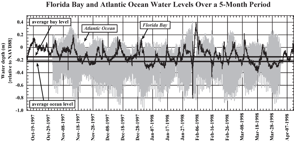
Figure 24. Graph shows five-month plot of water-level fluctuations in Florida Bay and the Atlantic Ocean (from Reich et al., 2002). Bay tides are meteorologically driven and fluctuate due to changes in wind forcing. Ocean tides are astronomically driven and semi-diurnal. Average bay-water level is ~12 to 15 cm higher than that of the ocean. This difference creates a drive for seaward cross-key groundwater flow. Water-level data are referenced to the North American Vertical Datum of 1988 (NAVD88).
|
Can't see the printable PDF version? Get the free Adobe Acrobat® Reader. |

![]() U.S. Department of the Interior |
U.S. Geological Survey
U.S. Department of the Interior |
U.S. Geological Survey
URL: [disc] /pubs/pp/2007/1751/professional-paper/tile1/figures/fig24.html
Page Contact Information: Feedback
Page Last Modified: December 01, 2016 @ 04:12 PM (JSS)
