FISC - St. Petersburg
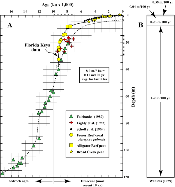
Figure 41. The sea-level curve for the Florida reef tract is well constrained by local proxy data (in conventional 14C ages) as modified (Lidz and Shinn, 1991) from the curve of Robbin (1984). (A) Data from 8 ka to the present are considered reliable. (B) Rates of sea-level rise. Upper part of figure shows actual rise measured by tide gauges at Key West (1932-present).
|
Can't see the printable PDF version? Get the free Adobe Acrobat® Reader. |

![]() U.S. Department of the Interior |
U.S. Geological Survey
U.S. Department of the Interior |
U.S. Geological Survey
URL: [disc] /pubs/pp/2007/1751/professional-paper/tile1/figures/fig41.html
Page Contact Information: Feedback
Page Last Modified: December 01, 2016 @ 04:12 PM (JSS)
