FISC - St. Petersburg
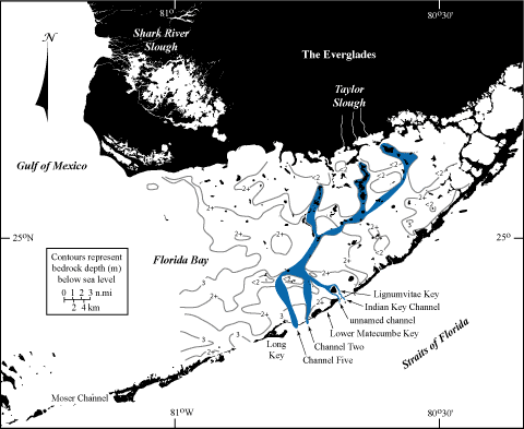
Figure 57. Drawing shows configuration of riverbed channels in Florida Bay Pleistocene bedrock (wide blue areas), as proposed by Davies (figure modified from Davies, 1980). A likely third tine in the channel fork exiting the bay was bifurcated by Lignumvitae Key (thin blue lines, USGS, unpublished data). Note location of ancient riverbeds relative to modern rivers draining Taylor Slough. Bay area bedrock depths below sea level are approximate and were determined by probing with a rod (Davies, 1980).
|
Can't see the printable PDF version? Get the free Adobe Acrobat® Reader. |

![]() U.S. Department of the Interior |
U.S. Geological Survey
U.S. Department of the Interior |
U.S. Geological Survey
URL: [disc] /pubs/pp/2007/1751/professional-paper/tile3/figures/fig57.html
Page Contact Information: Feedback
Page Last Modified: December 01, 2016 @ 04:13 PM (JSS)
