FISC - St. Petersburg
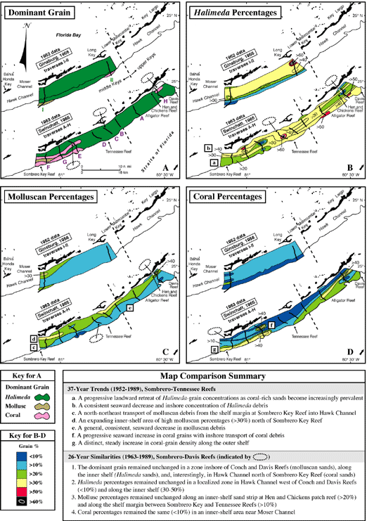
Figure 62. (A-D) Contour maps show 1952 and 1963 grain-type data between Sombrero Key and Tennessee Reefs (distance ~18 km; Ginsburg, 1956) and Sombrero Key and Davis Reefs (distance ~35 km; Swinchatt, 1965) in the middle Keys area (dashed lines delineate middle and upper Keys; from Lidz and Hallock, 2000). The 1952 maps, based on sparse samples (16 sites along two traverses), cannot be compared closely to the later maps but are useful for a sense of sediment composition in the area in 1952. The 1963 maps, more detailed and covering a broader area, are more comparable to those for 1989. The maps indicate a significant increase in the coral component of the sediments.
|
Can't see the printable PDF version? Get the free Adobe Acrobat® Reader. |

![]() U.S. Department of the Interior |
U.S. Geological Survey
U.S. Department of the Interior |
U.S. Geological Survey
URL: [disc] /pubs/pp/2007/1751/professional-paper/tile3/figures/fig62.html
Page Contact Information: Feedback
Page Last Modified: December 01, 2016 @ 04:13 PM (JSS)
