FISC - St. Petersburg
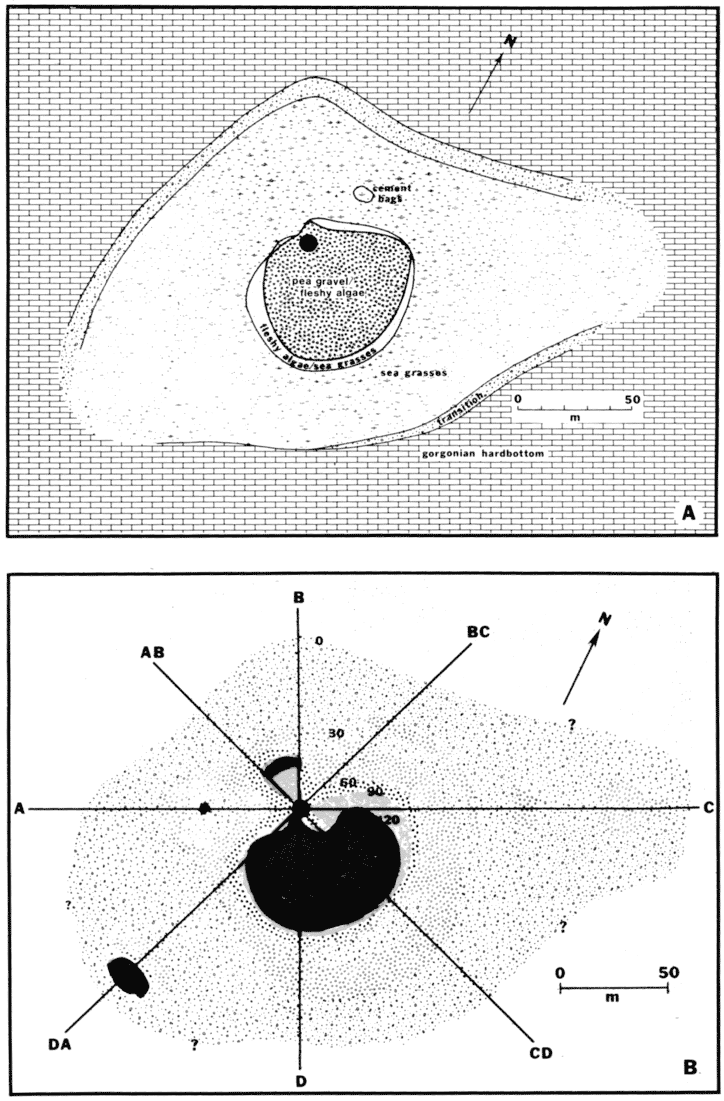
Figure 120. Well site D/E-1 (from Dustan et al., 1991). (A) Map of biological communities was derived from a census assessment along eight transects radiating from the main (>100) cement-bag pile (large black dot). Smaller pile of 8 to 10 bags lay northeast of the main pile. Well E-1 was thought to be under the main pile and well D under the pea-gravel drill pad south of E-1. Mostly exposed Pleistocene bedrock populated by gorgonians, sponges, and scattered corals surrounded the drill sites. Sea grasses grew in local sediment-filled depressions throughout the area. (B) Pea gravel and/or sediment thickness (in cm) was determined from probes taken along the radial-transect lines. Area near the center was >150 cm thick. Small bulls eye southwest of site was a local sediment-filled bedrock depression.
|
Can't see the printable PDF version? Get the free Adobe Acrobat® Reader. |

![]() U.S. Department of the Interior |
U.S. Geological Survey
U.S. Department of the Interior |
U.S. Geological Survey
URL: [disc] /pubs/pp/2007/1751/professional-paper/tile9-10/figures/fig120.html
Page Contact Information: Feedback
Page Last Modified: December 01, 2016 @ 04:15 PM (JSS)
