FISC - St. Petersburg
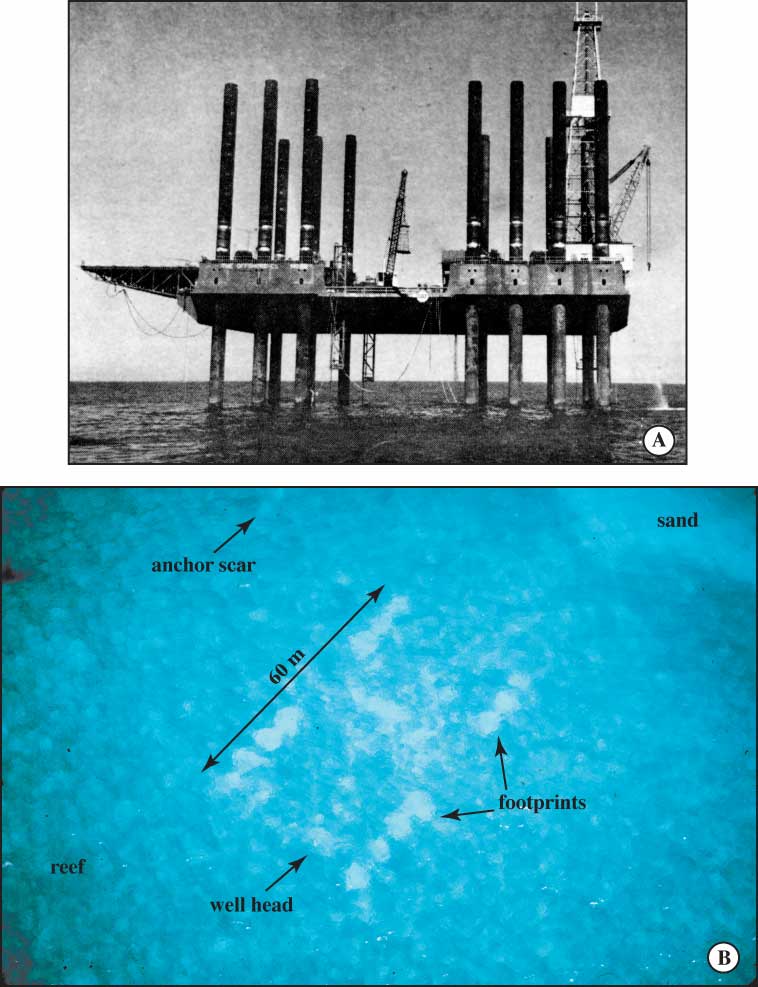
Figure 123. Well site A. (A) Offshore Company Rig 52 drilling well A for Gulf Oil Company in 1960. Note drill derrick over well bore at right. Also note drill mud and rock cuttings being dumped into water at right. Quadrat A-1 was located beneath area of drilling effluents. Photo is courtesy of the Oil and Gas Journal. (B) Low-level oblique aerial photograph taken in 1988 shows 14 sand-filled footprints, wellhead, and an anchor-chain scar (from Dustan et al., 2001). The anchor chain holding a marker buoy had made 360° sweeps of the bottom in heavy weather, completely scouring the bottom free of live corals. The bare zone was ~15 m in diameter. The amount of anchor-chain destruction implies that damage by support vessels may be greater than that caused by the drill platform (Dustan et al., 1991). Area at right is carbonate sand that lacked coral or gorgonian growth.
|
Can't see the printable PDF version? Get the free Adobe Acrobat® Reader. |

![]() U.S. Department of the Interior |
U.S. Geological Survey
U.S. Department of the Interior |
U.S. Geological Survey
URL: [disc] /pubs/pp/2007/1751/professional-paper/tile9-10/figures/fig123.html
Page Contact Information: Feedback
Page Last Modified: December 01, 2016 @ 04:15 PM (JSS)
