Professional Paper 1386–A
Select image for high resolution and Save to download 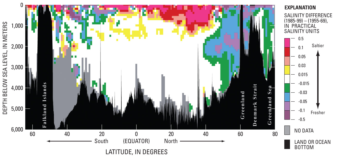 Figure 14. Salinity difference (1985 to 1999) minus (1955 to 1969), by depth, along a western Atlantic Ocean meridional transect from lat 80° N (Fram Strait) to lat 64° S (Antarctica). Figure based on and updated from Curry and others (2003). |

![]() U.S. Department of the Interior |
U.S. Geological Survey
U.S. Department of the Interior |
U.S. Geological Survey
URL: http://pubsdata.usgs.gov/pubs/pp/p1386a/gallery1-fig14.html
Page Contact Information: GS Pubs Web Contact
Page Last Modified: Thursday, 01-Dec-2016 16:24:48 EST
