Professional Paper 1386–A
Select image for high resolution and Save to download 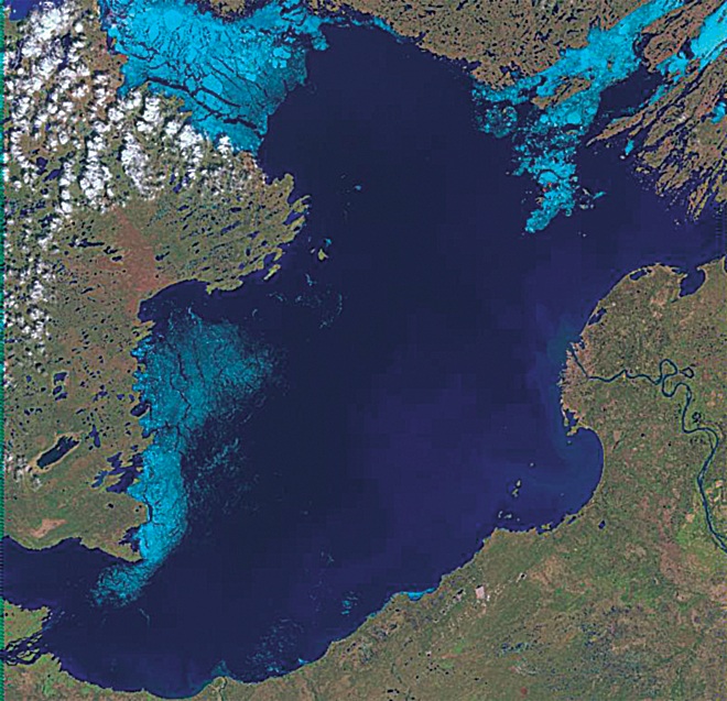 Figure 5–3C. Three Landsat-7 ETM+ images (bands 3, 4, 5) of the breakup of ice on Great Slave Lake, Northwest Territories, Canada (at about latitude 61.5°N., longitude 14.5°W.) on (C) 5 June 2000. Lake ice is shown in light blue, open water in dark blue. Each image covers an area of 185 km by 185 km. |

![]() U.S. Department of the Interior |
U.S. Geological Survey
U.S. Department of the Interior |
U.S. Geological Survey
URL: http://pubsdata.usgs.gov/pubs/pp/p1386a/notes-fig5-3c.html
Page Contact Information: GS Pubs Web Contact
Page Last Modified: Thursday, 01-Dec-2016 16:26:29 EST
