Professional Paper 1386–A
Select image for high resolution and Save to download 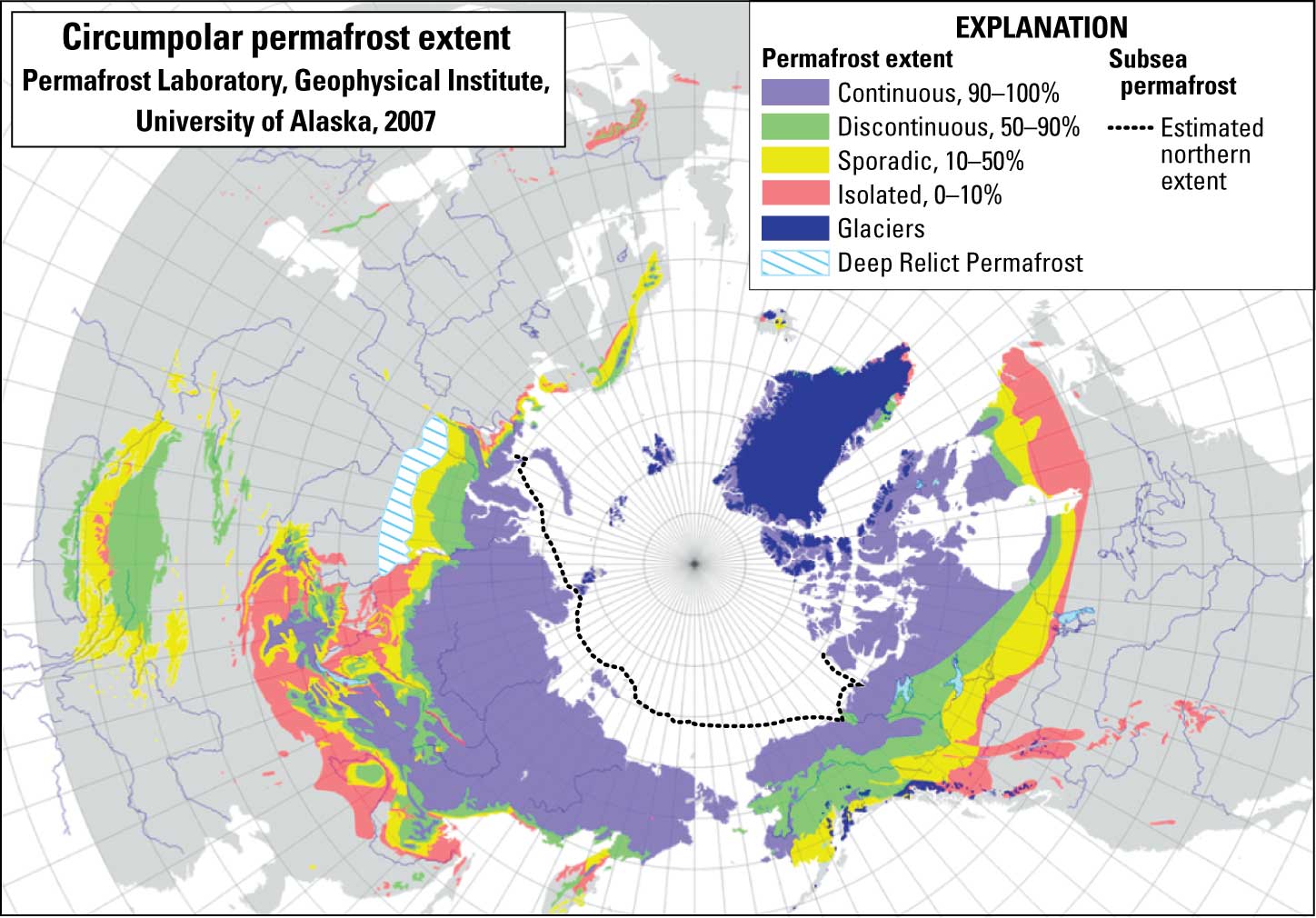 Figure 6–1. Map showing areal distribution of permafrost regions in the Northern Hemisphere. Prepared in 2007 by the Permafrost Laboratory, Geophysical Institute, University of Alaska Fairbanks. Map derived from the electronic version of the “Circum-Arctic Map of Permafrost and Ground-Ice Conditions” (Brown and others, 1997, http://nsidc.org/fgdc/). |

![]() U.S. Department of the Interior |
U.S. Geological Survey
U.S. Department of the Interior |
U.S. Geological Survey
URL: http://pubsdata.usgs.gov/pubs/pp/p1386a/notes-fig6-1.html
Page Contact Information: GS Pubs Web Contact
Page Last Modified: Thursday, 01-Dec-2016 16:26:30 EST
