
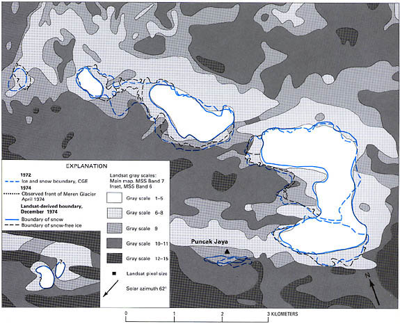
Figure ll.-Satellite-derived boundary of the Puncak Jaya glaciers in 1974
compared with the 1972 CGE boundary. Inset shows the 1974 boundary of the Ngga
Pilimsit ice cap, 12 km west-northwest of Puncak Jaya. (See text section "Observation
and Mapping of the Glaciers Shown on Landsat Images" for a discussion of the method
used to produce the figure.)
U.S. Geological Survey,
U.S.Department of the Interior
This page is https://pubs.usgs.gov/prof/p1386h/indonesia/infig11.html
Contact: Richard S. Williams, Jr.,
and Jane G. Ferrigno
Last modified 05.04.00