![]()
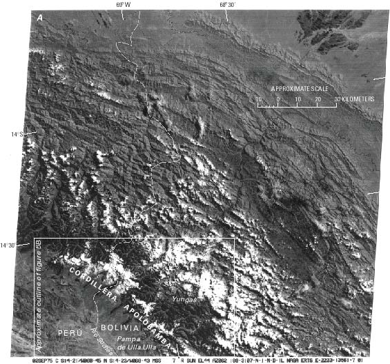
Figure 5.--Cordillera Apolobamba in Perú and Bolivia. A, Landsat 2 MSS image of the cordillera acquired when substantial amounts of snow cover were present. Contrast with figure 8. The white spots located east of the glaciated mountain chain are not snowfields, but cloudfields that, as a rule, reach the glacier areas by noon and protect them from direct solar radiation. Landsat image (2223-13561, band 7; 2 September 1975; Path 1, Row 70) from the EROS Data Center, Sioux Falls, S. Dak.
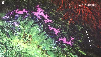
B, Landsat 5 TM false-color composite image of the Cordillera Apolobamba acquired 21 August 1991. The color composite was generated by using bands 3, 5, and 4 and shows the sharply defined glacierized areas in pink (see A for approximate location of B). Also, it is possible to see Pleistocene moraines around the "finger lakes."
| Click the "Close" box to exit this window. |
U.S. Geological Survey, U.S.Department of the Interior