![]()
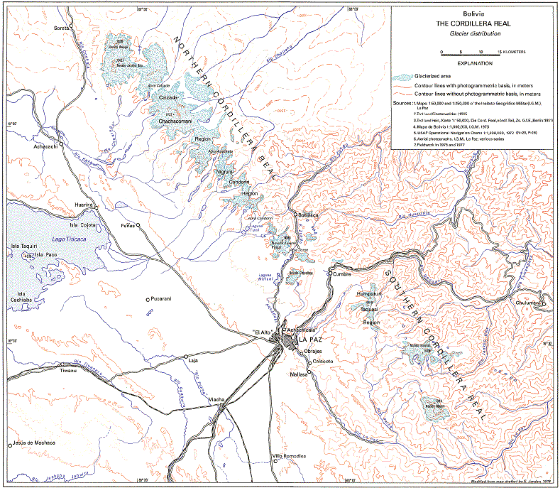
Figure 6.--Glacier distribution in the Cordillera Real. The map, drawn by the author, is based on field studies, aerial photographs, and various topographic maps. Compare with Landsat image of the Cordillera Real in figure 8.
| Click the "Close" box to exit this window. |
U.S. Geological Survey, U.S.Department of the Interior