![]()
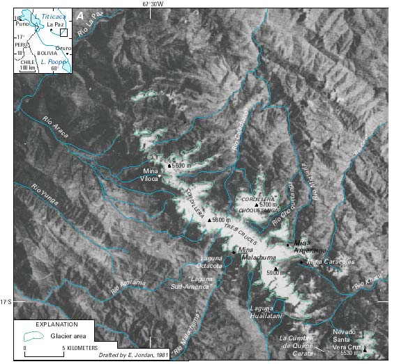
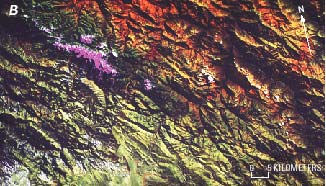
Figure 7.--Glacierized regions of the Cordillera Tres Cruces and Nevado Santa Vera Cruz. A, Annotated enlargement of part of a Landsat 2 MSS image and overlay based on topographic maps, field studies, aerial photographs, and satellite images. Landsat image (2276-13505, band 7; 25 October 1975; Path 251, Row 72) from the EROS Data Center, Sioux Falls, S. Dak. [Approximate scale, 1:250,000.] Abbreviation: L., Laguna.
B, Landsat 5 TM false-color composite image of the same area, acquired 7 May 1993. The color composite was generated by using bands 3, 5, and 4 and shows the glacierized areas in pink.
| Click the "Close" box to exit this window. |
U.S. Geological Survey, U.S.Department of the Interior